
IMAGES TAKEN NEAR TO
Cameronian Drive, BELFAST, BT5 6AW
Introduction
This page details the photographs taken nearby to Cameronian Drive, BT5 6AW by members of the Geograph project.
The Geograph project started in 2005 with the aim of publishing, organising and preserving representative images for every square kilometre of Great Britain, Ireland and the Isle of Man.

There are currently over 7.5m images from over14,400 individuals and you can help contribute to the project by visiting https://www.geograph.org.uk
Image Map
Images are licensed for reuse under creativecommons.org/licenses/by-sa/2.0
Notes
- Clicking on the map will re-center to the selected point.
- The higher the marker number, the further away the image location is from the centre of the postcode.
Image Listing (15 Images Found)
Images are licensed for reuse under creativecommons.org/licenses/by-sa/2.0
Image
Details
Distance
1
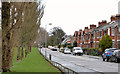
Houston Park, Belfast
A long street, built in the “inter-war” period, running north east off the Castlereagh Road. Orangefield Park http://www.geograph.org.uk/snippet/6092 is on the left and straight ahead.
Image: © Albert Bridge
Taken: 1 Feb 2014
0.09 miles
2
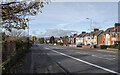
The Castlereagh Road, Belfast
The Castleragh Road (A23), a wide arterial route in and out of Belfast from the east.
Image: © Rossographer
Taken: 15 Nov 2021
0.21 miles
3
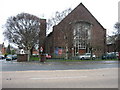
Orangefield Presbyterian Church
On Castlereagh Road.
Image: © Brian Shaw
Taken: 18 Jan 2006
0.21 miles
4
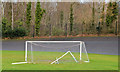
Goalposts and cycle track, Orangefield Park, Belfast
The eastern side of Orangefield Park seen from close to Houston Park. The hockey goalposts seem to be disused. The cycle track/velodrome (background) opened in 1957 and is still in use.
Image: © Albert Bridge
Taken: 1 Feb 2014
0.21 miles
5
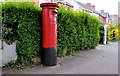
Pillar box, Belfast
GR pillar box, on the Castlereagh Road, opposite Orangefield Crescent.
Image: © Albert Bridge
Taken: 24 May 2011
0.21 miles
6
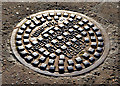
Needham "Grip-Fix" manhole cover, Belfast (2)
See Image (Sandy Row). This one is in the footpath on the Castlereagh Road close to Houston Park. This part of the Castlereagh Road is lightly-trodden. The cover is only slightly worn. Note the guide marks (top left) to ensure that the cover is correctly aligned. The design and inscription are emphasised by the side lighting. Image shows another “Grip-Fix” of older design.
Image: © Albert Bridge
Taken: 17 Nov 2012
0.22 miles
7
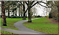
Park path, Belfast (2)
A path in Orangefield Park.
Image: © Albert Bridge
Taken: 31 Dec 2011
0.22 miles
8
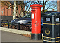
Pillar box, Castlereagh, Belfast
GVIR pillar box (BT5 439), beside a litter bin, on the Castlereagh Road, close to Orby Street (Orby Drive) on the Google map.
Image: © Albert Bridge
Taken: 17 Nov 2012
0.22 miles
9
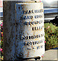
Boundary post, Castlereagh Road, Belfast (2)
See Image The inscription “PARLIAMENTARY AND MUNICIPAL BOUNDARY BELFAST POTTINGER DIVISION POTTINGER WARD 1918”.
Image: © Albert Bridge
Taken: 17 Nov 2012
0.23 miles
10
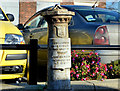
Boundary post, Castlereagh Road, Belfast (1)
Former Belfast Corporation boundary post, at Orangefield Presbyterian church Image, on the Castlereagh Road. Image shows the inscription.
Image: © Albert Bridge
Taken: 17 Nov 2012
0.23 miles