
IMAGES TAKEN NEAR TO
Glenmanus Park, PORTRUSH, BT56 8PF
Introduction
This page details the photographs taken nearby to Glenmanus Park, BT56 8PF by members of the Geograph project.
The Geograph project started in 2005 with the aim of publishing, organising and preserving representative images for every square kilometre of Great Britain, Ireland and the Isle of Man.

There are currently over 7.5m images from over14,400 individuals and you can help contribute to the project by visiting https://www.geograph.org.uk
Image Map
Images are licensed for reuse under creativecommons.org/licenses/by-sa/2.0
Notes
- Clicking on the map will re-center to the selected point.
- The higher the marker number, the further away the image location is from the centre of the postcode.
Image Listing (5 Images Found)
Images are licensed for reuse under creativecommons.org/licenses/by-sa/2.0
Image
Details
Distance
1
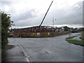
Portrush Lidl
Construction of a new Lidl in Portrush. Situated between the Glenmanus Road and the Coleraine Road on the long vacant site formerly occupied by Boyd's Garage.
Image: © Willie Duffin
Taken: 14 May 2012
0.12 miles
2
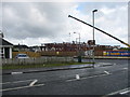
Portrush Lidl (2)
Taken from the Coleraine Road. Construction had only started in the previous few weeks and already the building is well underway.
Image: © Willie Duffin
Taken: 14 May 2012
0.15 miles
3
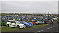
Camp site
The "Tented Village" at Glenmanus. This is a camp site used by fans and spectators at the N.W.200.
Image: © Willie Duffin
Taken: 17 May 2008
0.17 miles
4
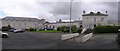
Magherabuoy House Hotel
It is located to the south of Portrush.
Image: © Kenneth Allen
Taken: 16 Aug 2007
0.22 miles
5
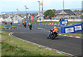
Riders in the Northwest 200 at Magheraboy chicane.
A recent addition to the course, the chicane was established to reduce the speeds of the competitors hurtling towards the Metropole corner. Prior to the chicane speeds of 200mph plus have been recorded.
Image: © Des Colhoun
Taken: 9 May 2007
0.24 miles