
IMAGES TAKEN NEAR TO
Clara Street, BELFAST, BT5 5GB
Introduction
This page details the photographs taken nearby to Clara Street, BT5 5GB by members of the Geograph project.
The Geograph project started in 2005 with the aim of publishing, organising and preserving representative images for every square kilometre of Great Britain, Ireland and the Isle of Man.

There are currently over 7.5m images from over14,400 individuals and you can help contribute to the project by visiting https://www.geograph.org.uk
Image Map
Images are licensed for reuse under creativecommons.org/licenses/by-sa/2.0
Notes
- Clicking on the map will re-center to the selected point.
- The higher the marker number, the further away the image location is from the centre of the postcode.
Image Listing (114 Images Found)
Images are licensed for reuse under creativecommons.org/licenses/by-sa/2.0
Image
Details
Distance
1
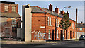
Clara Street, Belfast
A late 19th century street, running from the Castlereagh Road (behind me) to the Beersbridge Road. Now redeveloped except for this short row at the corner of Ravensdale Street (left).
Image: © Albert Bridge
Taken: 16 Nov 2011
0.02 miles
2
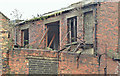
Nos 193-203 Beersbridge Road, Belfast - December 2015(2)
Outbuildings seen from the north west.
Image: © Albert Bridge
Taken: 14 Dec 2015
0.03 miles
3
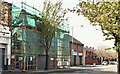
Nos 183-191 Beersbridge Road, Belfast (April 2019)
The apartments, under construction and well hidden by shadow, scaffolding and mesh.
Image: © Albert Bridge
Taken: 22 Apr 2019
0.03 miles
4
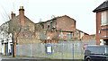
Nos 183-191 Beersbridge Road, Belfast (December 2017)
Nos 193-203 http://www.geograph.org.uk/snippet/14343 are on the left.
Image: © Albert Bridge
Taken: 7 Dec 2017
0.03 miles
5
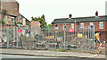
Nos 183-191 Beersbridge Road, Belfast (June 2018)
An early stage of constructing new housing association apartments.
Image: © Albert Bridge
Taken: 15 Jun 2018
0.03 miles
6
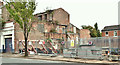
Nos 183-191 Beersbridge Road, Belfast (August 2018)
The derelict buildings (left) have been shored for the duration of the work.
Image: © Albert Bridge
Taken: 18 Aug 2018
0.03 miles
7
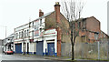
Nos 193-203 Beersbridge Road, Belfast - December 2015(1)
The buildings seen from the north west.
Image: © Albert Bridge
Taken: 14 Dec 2015
0.03 miles
8
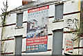
Nos 193-203 Beersbridge Road, Belfast - December 2015(3)
An old poster advertising the original “Eastbridge” development.
Image: © Albert Bridge
Taken: 14 Dec 2015
0.03 miles
9
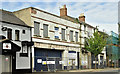
Nos 193 - 203 Beersbridge Road, Belfast (May 2019)
Now fenced and with a sign announcing new housing association apartments, the days of these long-derelict buildings appear to be numbered.
Image: © Albert Bridge
Taken: 12 May 2019
0.03 miles
10
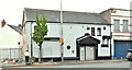
"Blades" social club, Belfast (June 2018)
Blades Social Club at 205 Beersbridge Road, opposite Mayflower Street. It used to have a plaque showing the date of founding (1930’s from memory) and once occupied premises at Ashfield Street.
I have no connection with the club and cannot enter into correspondence.
Image: © Albert Bridge
Taken: 15 Jun 2018
0.04 miles