
IMAGES TAKEN NEAR TO
Moorgate Street, BELFAST, BT5 5BZ
Introduction
This page details the photographs taken nearby to Moorgate Street, BT5 5BZ by members of the Geograph project.
The Geograph project started in 2005 with the aim of publishing, organising and preserving representative images for every square kilometre of Great Britain, Ireland and the Isle of Man.

There are currently over 7.5m images from over14,400 individuals and you can help contribute to the project by visiting https://www.geograph.org.uk
Image Map
Images are licensed for reuse under creativecommons.org/licenses/by-sa/2.0
Notes
- Clicking on the map will re-center to the selected point.
- The higher the marker number, the further away the image location is from the centre of the postcode.
Image Listing (356 Images Found)
Images are licensed for reuse under creativecommons.org/licenses/by-sa/2.0
Image
Details
Distance
1
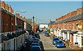
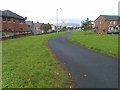
Moorgate Street, Belfast
Moorgate Street lies on the other side of the old Belfast and County Down Railway (now the Comber Greenway and formerly the Bloomfield Walkway) from Evelyn Avenue Image and runs to Ravenscroft Avenue Image middle. Bloomfield Avenue Image is in the background.
Image: © Albert Bridge
Taken: 24 Jun 2009
0.02 miles
2
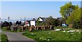
Comber Greenway
A pile of pallets stacked neatly beside the path ready for the 11th July Bonfire (bonefire in the local patios) Night. Near Holywood Arches.
Image: © Robert Ashby
Taken: 22 Apr 2015
0.03 miles
3
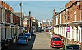
Moorfield Street, Belfast (1)
Moorfield Street runs, parallel to Moorgate Street Image, from the old Belfast and County Down Railway (now the Comber Greenway and formerly the Bloomfield Walkway) to Ravenscroft Avenue Image middle. Bloomfield Avenue Image is in the background. See also Image
Image: © Albert Bridge
Taken: 24 Jun 2009
0.04 miles
4
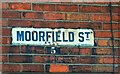
Moorfield Street, Belfast (2)
See Image An enamel sign, at the north eastern end of the street. The pre-postcode postal district “5” (now BT5) is painted on the brick.
Image: © Albert Bridge
Taken: 24 Jun 2009
0.04 miles
6
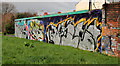
Graffiti, Belfast
Some vivid graffiti, opposite Crystal Street Image, along the walkway (formerly the railway to Comber).
Image: © Albert Bridge
Taken: 5 Mar 2012
0.04 miles
7
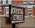
Crystal Street sign, Belfast
The tiled sign at the Ravenscroft Avenue Image end of Crystal Street. Sometimes it’s possible to detect a pattern in street naming (rivers, towns etc) but, in this case, where the adjacent streets are Beechwood and Moorfield the name cannot be explained. Further information very welcome.
Image: © Albert Bridge
Taken: 5 Mar 2012
0.06 miles
8
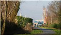
Old railway, Belfast (4)
See Image This is the line as it approaches the site of Bloomfield station Image on the Beersbridge Road. The slight elevation here gives a good view, even on a misty day, of the Stena ferry berth and the Harland & Wolff cranes (middle right).
Image: © Albert Bridge
Taken: 11 Feb 2008
0.07 miles
9
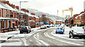
December snow, Belfast 2009-6
See Image At 10.35, the snow on the ground in Ravenscroft Avenue Image was being worn by the passing traffic. The view is towards the Newtownards Road with the library Image below the Harland & Wolff cranes. Continue to Image
Image: © Albert Bridge
Taken: 20 Dec 2009
0.07 miles
10

The Comber Greenway
The greenway heading towards Belfast as it crosses the Beersbridge Road.
Image: © Rossographer
Taken: 10 May 2025
0.07 miles