IMAGES TAKEN NEAR TO
Bloomfield Avenue, BELFAST, BT5 5AE

Introduction

This page details the photographs taken nearby to Bloomfield Avenue, BT5 5AE by members of the Geograph project.

The Geograph project started in 2005 with the aim of publishing, organising and preserving representative images for every square kilometre of Great Britain, Ireland and the Isle of Man.

There are currently over 7.5m images from over14,400 individuals and you can help contribute to the project by visiting https://www.geograph.org.uk

Image Map


Images are licensed for reuse under creativecommons.org/licenses/by-sa/2.0
Notes
  • Clicking on the map will re-center to the selected point.
  • The higher the marker number, the further away the image location is from the centre of the postcode.

Image Listing (349 Images Found)

Images are licensed for reuse under creativecommons.org/licenses/by-sa/2.0
  • ...
Image
Details
Distance
1
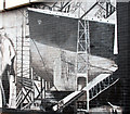
Mural, east Belfast (3)
See Image The same (black and white) mural, in Bloomfield Avenue, also includes this reference to the “Titanic”.
Image: © Albert Bridge Taken: 28 Mar 2011
0.00 miles
2
Election posters, East Belfast 2010-2
See Image The Westminster general election is set for 6 May 2010. This is one in a series showing the election posters on display in the East Belfast constituency. Note for conspiracy theorists: the order of submission is determined by the order in which I saw them and does not (repeat not) indicate any preference for any particular member or party. David Vance poster in Bloomfield Avenue. Continue to Image
Image: © Albert Bridge Taken: 15 Apr 2010
0.01 miles
3
Bloomfield Congregational church, Belfast (2011)
A church, at the corner of Bloomfield Avenue and Roseberry Street (right) which seems to date from circa 1902 when it might have been known as Bloomfield Independent Church. There was an application for planning permission (September 2010) as follows “1390/F Bloomfield Congregational Church , Bloomfield Avenue , Belfast Demolition of existing church and erection of new replacement church”. Image shows the vacant site in December 2012.
Image: © Albert Bridge Taken: 22 Aug 2011
0.02 miles
4
Bloomfield Congregational church, Belfast (2012)
See Image (August 2011). The church has now been demolished. Bloomfield Avenue is on the left, Ulsterdale Street the background and Roseberry Street the foreground. Image shows the new church under construction in April 2013.
Image: © Albert Bridge Taken: 28 Dec 2012
0.02 miles
5
Bloomfield Avenue Congregational church, Belfast (2013-3)
See Image The completed church seen from the corner of Roseberry Street.
Image: © Albert Bridge Taken: 14 Aug 2013
0.02 miles
6
Bloomfield Congregational Church, Belfast (2013-1)
See Image (December 2012). The new church under construction. Image shows the completed church in August 2013.
Image: © Albert Bridge Taken: 11 Apr 2013
0.02 miles
7
"Top Up", Belfast (January 2015)
A café in these premises Image at 139 Bloomfield Avenue. One of the many shops, vacant during the long recession, now back in productive use. Continue to Image
Image: © Albert Bridge Taken: 11 Jan 2015
0.02 miles
8
Decorated shutter door, Belfast
A decorated shutter door, in Bloomfield Avenue, on what was “The Trafalgar” chippy. More recently known as “The Filling Station”. Image shows the premises back in use.
Image: © Albert Bridge Taken: 5 Mar 2012
0.02 miles
9
Bloomfield Avenue Congregational church, Belfast (2013-2)
See Image (April 2013). The completed church seen from the corner of Ulsterdale Street. Image shows the view in the opposite direction.
Image: © Albert Bridge Taken: 14 Aug 2013
0.03 miles
10
No 139 Bloomfield Avenue, Belfast (March 2018)
See Image The former Trafalgar chip shop, now vacant again and to let.
Image: © Albert Bridge Taken: 4 Mar 2018
0.03 miles
  • ...