1
"Never too Old" mural, Ballymacarrett, Belfast (March 2016)
A new mural on the Newtownards Road. The inscription reads “You are never too old to set another goal or to dream a new dream”.
Image: © Albert Bridge
Taken: 27 Mar 2016
0.05 miles
2
Fallen tree, Ballymacarrett, Belfast (September 2018)
Belfast seems to have missed most of the serious effects of Storm Ali. This tree had fallen across the footpath at the lower end of the Newtownards Road.
Image: © Albert Bridge
Taken: 20 Sep 2018
0.05 miles
3
Telephone box, Ballymacarrett, Belfast (February 2015)
A KX100 telephone box on the Newtownards Road. This church
Image is in the background.
Image: © Albert Bridge
Taken: 13 Feb 2015
0.06 miles
4
Newtownards Road, Ballymacarrett
The Newtownards Road in its lowermost section at Ballymacarrett. View towards Dundonald and Newtownards.
Image: © Dean Molyneaux
Taken: 9 Jul 2009
0.06 miles
5
"Titanic" mural, Belfast
Completed last week on the wall of a house on the Newtownards Road. It replaced one of a political nature. This one
Image is out of picture on the left. See also
Image
Image: © Albert Bridge
Taken: 26 May 2010
0.06 miles
6
Former Bryson Street Surgery, Belfast - February 2015(1)
See
Image (February 2012). The former Bryson Street Surgery - now gutted and partly demolished. It moved to here
Image Continue to
Image – 15 February 2015.
Image: © Albert Bridge
Taken: 13 Feb 2015
0.06 miles
7
Former Bryson Street Surgery, Belfast - February 2015(2)
See
Image (two days ago). The last remaining part of the ground floor.
Image: © Albert Bridge
Taken: 15 Feb 2015
0.06 miles
8
New Bryson Street Surgery, Belfast - May 2015(1)
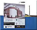
Work has started behind the hoarding.
Image: © Albert Bridge
Taken: 16 May 2015
0.06 miles
9
New Bryson Street Surgery, Belfast - May 2015(2)
The architects’ impression of the completed surgery. The building, officially described as “A project for the development of the derelict site on Bryson Street to a 680m2 purpose built Community Doctor’s Surgery”, is one of many proposed under the Social Investment Fund “set up to deliver social change” is part of a wider scheme throughout Belfast.
Image: © Albert Bridge
Taken: 16 May 2015
0.06 miles
10
New Bryson Street Surgery, Belfast (June 2015)
Brickwork starting to rise above the hoarding.
Image: © Albert Bridge
Taken: 28 Jun 2015
0.06 miles


