IMAGES TAKEN NEAR TO
Union Street, COLERAINE, BT52 1QA
Introduction
This page details the photographs taken nearby to Union Street, BT52 1QA by members of the Geograph project.
The Geograph project started in 2005 with the aim of publishing, organising and preserving representative images for every square kilometre of Great Britain, Ireland and the Isle of Man.

There are currently over 7.5m images from over14,400 individuals and you can help contribute to the project by visiting https://www.geograph.org.uk
Image Map
Images are licensed for reuse under creativecommons.org/licenses/by-sa/2.0
Notes
- Clicking on the map will re-center to the selected point.
- The higher the marker number, the further away the image location is from the centre of the postcode.
Image Listing (316 Images Found)
Images are licensed for reuse under creativecommons.org/licenses/by-sa/2.0
Image
Details
Distance
1
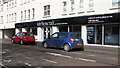
Kitchencraft, Circular Road
A kitchen show-room on Circular Road.
Image: © Willie Duffin
Taken: 9 Apr 2012
0.02 miles
2
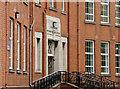
Coleraine Tech (1)
What is now the Coleraine campus of the Northern Regional College was once Coleraine Technical College and before that Coleraine Technical School. This building, at Union Street, dates from 1930 and has the name “Coleraine Technical 1930 School” above the door. It was subsequently extended by the addition of a new building (see Image) at the back. The 1918 directory shows “Technical School, Lodge Road” and “Technical Instruction Committee, Union Street”.
Image: © Albert Bridge
Taken: 3 Aug 2012
0.02 miles
3
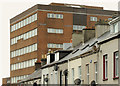
Coleraine Tech (2)
See Image The later extension, at the back, rising behind Brook Street.
Image: © Albert Bridge
Taken: 3 Aug 2012
0.04 miles
4
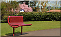
Park bench, Coleraine (1)
An “Ollerton” bench Image at the Union Street end of Anderson Park.
Image: © Albert Bridge
Taken: 14 Apr 2012
0.06 miles
5
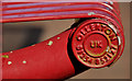
Park bench, Coleraine (2)
See Image The maker’s name http://www.ollerton.co.uk/.
Image: © Albert Bridge
Taken: 14 Apr 2012
0.06 miles
6
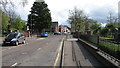
Circular Road, Coleraine
Looking towards the Brook Street junction.
Image: © Willie Duffin
Taken: 9 Apr 2012
0.06 miles
7
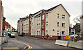
Foundry Court, Coleraine
A block of apartments built on the site of Moore’s Foundry Image, Brook Street.
Image: © Albert Bridge
Taken: 11 Jan 2012
0.06 miles
8
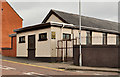
Gospel Hall, Coleraine
Gospel Hall at the Union Street end of Brook Street.
Image: © Albert Bridge
Taken: 29 Feb 2012
0.07 miles
9
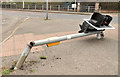
Traffic light, Coleraine
A traffic light (no longer in working order) at the corner of the Millburn Road and Union Street (background).
Image: © Albert Bridge
Taken: 24 Mar 2012
0.07 miles