IMAGES TAKEN NEAR TO
Brook Place, COLERAINE, BT52 1PR
Introduction
This page details the photographs taken nearby to Brook Place, BT52 1PR by members of the Geograph project.
The Geograph project started in 2005 with the aim of publishing, organising and preserving representative images for every square kilometre of Great Britain, Ireland and the Isle of Man.

There are currently over 7.5m images from over14,400 individuals and you can help contribute to the project by visiting https://www.geograph.org.uk
Image Map
Images are licensed for reuse under creativecommons.org/licenses/by-sa/2.0
Notes
- Clicking on the map will re-center to the selected point.
- The higher the marker number, the further away the image location is from the centre of the postcode.
Image Listing (261 Images Found)
Images are licensed for reuse under creativecommons.org/licenses/by-sa/2.0
Image
Details
Distance
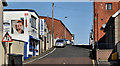
1
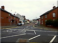
Circular Road, Coleraine
Heading east across Brook Street
Image: © Kenneth Allen
Taken: 7 Sep 2014
0.01 miles
2
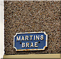
Martins Brae sign, Coleraine
Cast sign at the Circular Road end of Martins Brae Image
Image: © Albert Bridge
Taken: 29 Feb 2012
0.02 miles
3
Foundry Mews, Coleraine
Heading south
See close-up of notice here Image]
Image: © Kenneth Allen
Taken: 7 Sep 2014
0.02 miles
4
The Lodge Burn, Coleraine (9)
Image: © Albert Bridge
Taken: 3 Aug 2012
0.03 miles
5
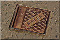
Stop valve cover, Coleraine
A small anonymous cover, over what might be a stop valve, on the Circular Road, close to Martin’s Brae Image
Image: © Albert Bridge
Taken: 11 May 2012
0.03 miles
6
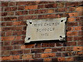
Plaque, Irish Church Schools 1871
Pictured here Image]
Image: © Kenneth Allen
Taken: 7 Sep 2014
0.03 miles
7
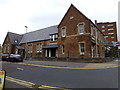
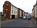
Old school buildings, Coleraine
It is located at the corner of Circular Road and Brook Street
See close-up of plaque here Image]
Image: © Kenneth Allen
Taken: 7 Sep 2014
0.03 miles
8
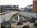
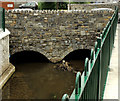
Culvert Coleraine
Recently upgraded this culvert runs through the centre of Coleraine.
Image: © Willie Duffin
Taken: 8 Jan 2014
0.03 miles
9
Martin's Brae, Coleraine
A steep street running from the Circular Road (out of picture – foreground) to Union Street.
Image: © Albert Bridge
Taken: 4 Apr 2012
0.04 miles
10
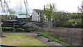
Building material, Anderson Park
The apartment block in the background is on Brook Street.
Image: © Willie Duffin
Taken: 9 Apr 2012
0.04 miles