IMAGES TAKEN NEAR TO
Railway Road, COLERAINE, BT52 1PE

Introduction

This page details the photographs taken nearby to Railway Road, BT52 1PE by members of the Geograph project.

The Geograph project started in 2005 with the aim of publishing, organising and preserving representative images for every square kilometre of Great Britain, Ireland and the Isle of Man.

There are currently over 7.5m images from over14,400 individuals and you can help contribute to the project by visiting https://www.geograph.org.uk

Image Map


Images are licensed for reuse under creativecommons.org/licenses/by-sa/2.0
Notes
  • Clicking on the map will re-center to the selected point.
  • The higher the marker number, the further away the image location is from the centre of the postcode.

Image Listing (218 Images Found)

Images are licensed for reuse under creativecommons.org/licenses/by-sa/2.0
  • ...
Image
Details
Distance
1
"PUFFIN" crossing, Coleraine (1)
A “PUFFIN” pedestrian crossing at the corner of the Railway Road and the Circular Road (out of picture to the left). One of twenty installed or to be installed at various places throughout NI. To quote from the official announcement “PUFFIN stands for Pedestrian User Friendly Intelligent Crossing. The major differences between PUFFINS and Pelicans are that PUFFINS have the red/green man on the push button unit beside the pedestrian; there is no flashing amber signal to drivers – they are held on a red signal until pedestrians have completed their crossing and the time for pedestrians to cross the road can be extended by sensors which detect people still on the crossing. Drivers also benefit from PUFFINS when a pedestrian pushes the push button and then moves away, the demand for the green man is cancelled so drivers do not experience an unnecessary delay.” This is the “red man” aspect. Image shows “green man” aspect.
Image: © Albert Bridge Taken: 11 Jan 2012
0.02 miles
2
"PUFFIN" crossing, Coleraine (2)
See Image showing the “red man” aspect. This is the “green man” aspect.
Image: © Albert Bridge Taken: 11 Jan 2012
0.02 miles
3
Cavanagh stop valve cover, Coleraine
A small Cavanagh cover, over what might be a stop valve, at the Railway Road end of the Circular Road.
Image: © Albert Bridge Taken: 11 May 2012
0.02 miles
4
Railway Road, Coleraine
Heading NNE
Image: © Kenneth Allen Taken: 31 May 2013
0.04 miles
5
Stop valve cover, Coleraine
A small anonymous cover, over what might be a stop valve, on the Circular Road, close to Martin’s Brae Image
Image: © Albert Bridge Taken: 11 May 2012
0.04 miles
6
Coleraine Leisure Centre
It is located along Railway Road
Image: © Kenneth Allen Taken: 31 May 2013
0.05 miles
7
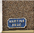
Martins Brae sign, Coleraine
Cast sign at the Circular Road end of Martins Brae Image
Image: © Albert Bridge Taken: 29 Feb 2012
0.05 miles
8
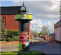
Advertising column, Coleraine
This is a “Colonne Morris” (advertising column), beside the Railway Road, donated to Coleraine by the French town of La Roche-sur-Yon http://en.wikipedia.org/wiki/La_Roche-sur-Yon#Administration with which it is twinned. The leisure centre/swimming pool is in the background.
Image: © Albert Bridge Taken: 4 Apr 2012
0.05 miles
9
Martin's Brae, Coleraine
A steep street running from the Circular Road (out of picture – foreground) to Union Street.
Image: © Albert Bridge Taken: 4 Apr 2012
0.06 miles
10
The Lodge Burn, Coleraine
The Lodge Burn, a short watercourse flowing through Coleraine into the Bann, is prone to flooding Image A major flood alleviation scheme is now underway. This view is downstream from the Railway Road bridge where the burn has been temporarily diverted. When complete this section will become “a rock ramp pool and weir fish pass”. Continue to Image (March 2012).
Image: © Albert Bridge Taken: 11 Jan 2012
0.06 miles
  • ...