
IMAGES TAKEN NEAR TO
Park Street, COLERAINE, BT52 1BD
Introduction
This page details the photographs taken nearby to Park Street, BT52 1BD by members of the Geograph project.
The Geograph project started in 2005 with the aim of publishing, organising and preserving representative images for every square kilometre of Great Britain, Ireland and the Isle of Man.

There are currently over 7.5m images from over14,400 individuals and you can help contribute to the project by visiting https://www.geograph.org.uk
Image Map
Images are licensed for reuse under creativecommons.org/licenses/by-sa/2.0
Notes
- Clicking on the map will re-center to the selected point.
- The higher the marker number, the further away the image location is from the centre of the postcode.
Image Listing (389 Images Found)
Images are licensed for reuse under creativecommons.org/licenses/by-sa/2.0
Image
Details
Distance
2

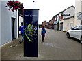
Park Street, Coleraine
Park Street runs off Church Street. Most of the houses are vacant pending rebuilding. Image shows a similar view in March 2012.
Image: © Albert Bridge
Taken: 16 Feb 1985
0.01 miles
3
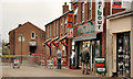
Park Street, Coleraine (2)
Image showed Park Street in February 1985 when it was mostly vacant houses awaiting redevelopment. This is a similar post-redevelopment view in 2012.
Image: © Albert Bridge
Taken: 24 Mar 2012
0.02 miles
4
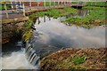
"Lake", Anderson Park, Coleraine
See Image This lake is in the section of the park between Brook Street and the Ramparts. It has become partly overgrown – possibly as a result of an accumulation of soil washed down by the stream which flows through it to the Bann. Image shows a similar view in April 2012 - after the flood alleviation work.
Image: © Albert Bridge
Taken: 15 Dec 2007
0.03 miles
5
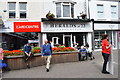
Herald's at 22, Coleraine
It is located along Church Street
Image: © Kenneth Allen
Taken: 14 Aug 2019
0.03 miles
6

Squires Pub, Coleraine
It was destroyed by fire some time ago
Image: © Kenneth Allen
Taken: 7 Sep 2014
0.03 miles
7

Church Lane, Coleraine
A narrow street, off Church Street (background), at the side of St Patrick’s church Image (behind the wall on the left). Not shown on the Google map.
Image: © Albert Bridge
Taken: 24 Mar 2012
0.03 miles
8

Fire-damaged bar, Coleraine
Damaged by fire in September 2011, “Squires” bar, Park Street, is advertised for sale. Previously “The Ramparts”.
Image: © Albert Bridge
Taken: 24 Mar 2012
0.03 miles
9

Stone pillar, North Rampart, Coleraine
Information sign on a stone pillar on the North Rampart, over-looking Anderson Park. In the back-ground is the Technical College.
Image: © Willie Duffin
Taken: 9 Apr 2012
0.03 miles
10

Squires Wine Bar, Coleraine
The burnt-out shell of this former public house and wine bar. It is situated on the corner of Park Street and the North Rampart.
Image: © Willie Duffin
Taken: 9 Apr 2012
0.03 miles