IMAGES TAKEN NEAR TO
Legavallon Road, COLERAINE, BT51 5BF
Introduction
This page details the photographs taken nearby to Legavallon Road, BT51 5BF by members of the Geograph project.
The Geograph project started in 2005 with the aim of publishing, organising and preserving representative images for every square kilometre of Great Britain, Ireland and the Isle of Man.

There are currently over 7.5m images from over14,400 individuals and you can help contribute to the project by visiting https://www.geograph.org.uk
Image Map
Images are licensed for reuse under creativecommons.org/licenses/by-sa/2.0
Notes
- Clicking on the map will re-center to the selected point.
- The higher the marker number, the further away the image location is from the centre of the postcode.
Image Listing (7 Images Found)
Images are licensed for reuse under creativecommons.org/licenses/by-sa/2.0
Image
Details
Distance
1
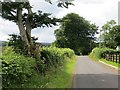
Temple Road
Here Temple Road has left the B64.
Image: © Richard Webb
Taken: 30 Jul 2013
0.10 miles
2
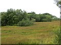
Wetland off Legavallon Road
The drier ground is wooded.
Image: © Richard Webb
Taken: 30 Jul 2013
0.10 miles
3
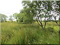
Wet farmland off Temple Road
An earlier view: Image
Image: © Richard Webb
Taken: 30 Jul 2013
0.12 miles
4
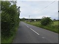
Legavallon Road
B64, west of when it leaves Temple Road.
Image: © Richard Webb
Taken: 30 Jul 2013
0.12 miles
5
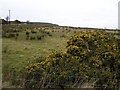
Smulgedon Townland
Looking north-east from the Belaugh Road
Image: © Kenneth Allen
Taken: 26 Mar 2008
0.13 miles
6
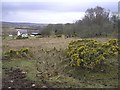
Smulgedon Townland
Looking south from the Belraugh Road
Image: © Kenneth Allen
Taken: 26 Mar 2008
0.13 miles
7
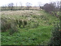
View south of Temple Road
Rough grazing land predominates.
Image: © Jonathan Billinger
Taken: 13 Nov 2007
0.19 miles