IMAGES TAKEN NEAR TO
Culmore Road, LONDONDERRY, BT48 7RS
Introduction
This page details the photographs taken nearby to Culmore Road, BT48 7RS by members of the Geograph project.
The Geograph project started in 2005 with the aim of publishing, organising and preserving representative images for every square kilometre of Great Britain, Ireland and the Isle of Man.

There are currently over 7.5m images from over14,400 individuals and you can help contribute to the project by visiting https://www.geograph.org.uk
Image Map
Images are licensed for reuse under creativecommons.org/licenses/by-sa/2.0
Notes
- Clicking on the map will re-center to the selected point.
- The higher the marker number, the further away the image location is from the centre of the postcode.
Image Listing (7 Images Found)
Images are licensed for reuse under creativecommons.org/licenses/by-sa/2.0
Image
Details
Distance
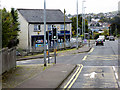
3
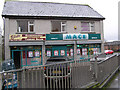
Mace Store
It is located near Pennyburn in Derry / Londonderry
Image: © Kenneth Allen
Taken: 18 Jan 2006
0.19 miles

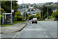
5
Hampstead Park, Derry
Off the Culmore Road.
Image: © Dean Molyneaux
Taken: 23 Aug 2009
0.22 miles

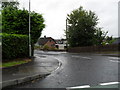
7
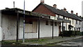
Old Community Centre: Belmont
Long disused and on the brink of demolition, this building would have been used for many activities in the past, such as Irish dancing classes and Tenant's Association meetings.
Image: © louise price
Taken: 4 Feb 2009
0.24 miles