IMAGES TAKEN NEAR TO
Nicholson Terrace, LONDONDERRY, BT48 7LW
Introduction
This page details the photographs taken nearby to Nicholson Terrace, BT48 7LW by members of the Geograph project.
The Geograph project started in 2005 with the aim of publishing, organising and preserving representative images for every square kilometre of Great Britain, Ireland and the Isle of Man.

There are currently over 7.5m images from over14,400 individuals and you can help contribute to the project by visiting https://www.geograph.org.uk
Image Map
Images are licensed for reuse under creativecommons.org/licenses/by-sa/2.0
Notes
- Clicking on the map will re-center to the selected point.
- The higher the marker number, the further away the image location is from the centre of the postcode.
Image Listing (120 Images Found)
Images are licensed for reuse under creativecommons.org/licenses/by-sa/2.0
Image
Details
Distance
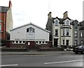
1
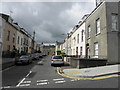
Nicholson Terrace, Derry / Londonderry
Pictured along Academy Road
Image: © Kenneth Allen
Taken: 6 Aug 2015
0.01 miles
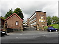
2
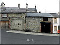
Old buildings, Derry / Londonderry
Pictured along Academy Road
Image: © Kenneth Allen
Taken: 6 Aug 2015
0.03 miles
3
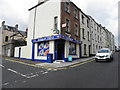
Academy Stores, Derry / Londonderry
Located at the corner of DeBrugh Terrace and Mountjoy Terrace
Image: © Kenneth Allen
Taken: 6 Aug 2015
0.03 miles
4
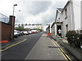
Academy Road, Derry / Londonderry
Heading north-west from Northland Row
Image: © Kenneth Allen
Taken: 6 Aug 2015
0.04 miles
5
Foyleville Residential Home, Derry / Londonderry
It is located along Academy Road
Image: © Kenneth Allen
Taken: 6 Aug 2015
0.07 miles
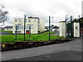
6
Model Primary School, Derry / Londonderry
It is located along Northland Row
Image: © Kenneth Allen
Taken: 6 Aug 2015
0.08 miles
7
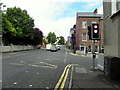
Francis Street, Derry / Londonderry
Heading north
Image: © Kenneth Allen
Taken: 6 Aug 2015
0.10 miles
8
Francis Street, Derry / Londonderry
Looking south
To the right is Infirmary Road
Image: © Kenneth Allen
Taken: 6 Aug 2015
0.11 miles
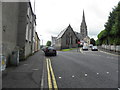
9
Derry / Donegal Christian Fellowship
It is located on the Northland Road
Image: © Kenneth Allen
Taken: 23 Oct 2009
0.12 miles
10
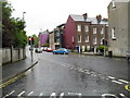
Francis Street at Infirmary Road
Eventually leads on to Pennyburn.
Image: © Dean Molyneaux
Taken: 23 Aug 2009
0.13 miles