IMAGES TAKEN NEAR TO
The Diamond, LONDONDERRY, BT48 6PG

Introduction

This page details the photographs taken nearby to The Diamond, BT48 6PG by members of the Geograph project.

The Geograph project started in 2005 with the aim of publishing, organising and preserving representative images for every square kilometre of Great Britain, Ireland and the Isle of Man.

There are currently over 7.5m images from over14,400 individuals and you can help contribute to the project by visiting https://www.geograph.org.uk

Image Map


Images are licensed for reuse under creativecommons.org/licenses/by-sa/2.0
Notes
  • Clicking on the map will re-center to the selected point.
  • The higher the marker number, the further away the image location is from the centre of the postcode.

Image Listing (1437 Images Found)

Images are licensed for reuse under creativecommons.org/licenses/by-sa/2.0
  • ...
Image
Details
Distance
1
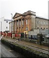
The First Derry Presbyterian Church, Magazine Street
This church was built in 1780 after the original dating from 1690 was demolished in 1777. The striking Corinthian portico was added later. As far as I understand the church is no longer functional but there are plans afoot to refurbish it for worship. The paint bombed building on the right is the Apprentice Boys Memorial Hall. http://www.derrycity.gov.uk/economicdevelopment/first_derry.asp
Image: © Eric Jones Taken: 19 Aug 2009
0.00 miles
2
The facade of the disused First Derry Presbyterian Church
Image: © Eric Jones Taken: 19 Aug 2009
0.00 miles
3
The renovated and reopened First Derry Presbyterian Church
Once marred by paint-bombs and with a dwindling congregation, this large church has with improved cross-community relationships been renovated and is again used for services. http://www.ilex-urc.com/Projects/First-Derry-Presbyterian-Church,-Magazine-Street.aspx
Image: © Eric Jones Taken: 23 Jul 2012
0.00 miles
4
First Derry Presbyterian Church
Image: © N Chadwick Taken: 21 Oct 2021
0.00 miles
5
First Derry Presbyterian Church
Image: © N Chadwick Taken: 21 Oct 2021
0.00 miles
6
Magazine Street, Derry / Londonderry
Looking north-east from the walls above Bishop's Gate
Image: © Kenneth Allen Taken: 6 Aug 2010
0.01 miles
7
Church board, First Derry Presbyterian Church
Pictured here Image]
Image: © Kenneth Allen Taken: 1 Aug 2012
0.01 miles
8
Blue Coat School Visitor Centre
Adjoining the Church is the refurbished Blue Coat School, now home to The Blue Coat School Visitor Centre. This new facility tells the history behind the Church, along with the history of Presbyterians in the city (and beyond) and the role they played in the great siege http://www.discovernorthernireland.com/First-Derry-Presbyterian-Church-and-The-Blue-Coat-School-Visitor-Centre-Londonderry-Derry-P3373 Pictured here Image]
Image: © Kenneth Allen Taken: 1 Aug 2012
0.01 miles
9
Derry - First Derry Presbyterian Church
Location is at the southeast corner of Magazine Street & Ferryquay Street. View is to the northeast from the Wall of Derry along Magazine Street. This church was opened in 1780. It is believed to also be on the site of an earlier 1690 Presbyterian Church. This church was closed for eight years to allow a complete renovation. It was recently reopened and is presently being utilized again as a place of worship.
Image: © Joseph Mischyshyn Taken: 24 Sep 2013
0.01 miles
10
Derry - First Derry Presbyterian Church
Location is at the southeast corner of Magazine Street & Ferryquay Street. View is to the northeast from the Wall of Derry along Magazine Street. This church was opened in 1780. It is believed to also be on the site of an earlier 1690 Presbyterian Church. This church was closed for eight years to allow a complete renovation. It was recently reopened and is presently being utilized again as a place of worship.
Image: © Joseph Mischyshyn Taken: 24 Sep 2013
0.01 miles
  • ...