
IMAGES TAKEN NEAR TO
Tirkeeran Park, LONDONDERRY, BT47 6YL
Introduction
This page details the photographs taken nearby to Tirkeeran Park, BT47 6YL by members of the Geograph project.
The Geograph project started in 2005 with the aim of publishing, organising and preserving representative images for every square kilometre of Great Britain, Ireland and the Isle of Man.

There are currently over 7.5m images from over14,400 individuals and you can help contribute to the project by visiting https://www.geograph.org.uk
Image Map
Images are licensed for reuse under creativecommons.org/licenses/by-sa/2.0
Notes
- Clicking on the map will re-center to the selected point.
- The higher the marker number, the further away the image location is from the centre of the postcode.
Image Listing (5 Images Found)
Images are licensed for reuse under creativecommons.org/licenses/by-sa/2.0
Image
Details
Distance
1
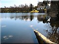
Houses at Lough Enagh Eastern
These houses are on the southern side of the lough along Judge's Road, a cul de sac just off the busy A2.
Image: © Kay Atherton
Taken: 5 Apr 2007
0.03 miles
2
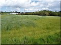
Field of white flax
White flax (Linium catharticum) growing on "set aside" land alongside a planting of barley.
Image: © Kay Atherton
Taken: 14 Jul 2007
0.03 miles
3
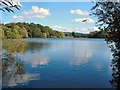
Lough Enagh Eastern
Lough Enagh Eastern taken from the northern side. A popular fishing lake for roach.
Image: © Kay Atherton
Taken: 7 Aug 2007
0.03 miles
4
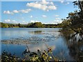
Crannog in Enagh Lough
The clump of trees in the centre of the lough is an ancient crannog or island, often man-made, where people and animals could be easily defended.
Image: © Kay Atherton
Taken: 7 Aug 2007
0.22 miles
5
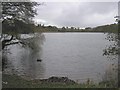
Enagh Lough
It is located to the east of the River Foyle
Image: © Kenneth Allen
Taken: 22 Nov 2006
0.25 miles