
IMAGES TAKEN NEAR TO
Bonds Hill, LONDONDERRY, BT47 6DW
Introduction
This page details the photographs taken nearby to Bonds Hill, BT47 6DW by members of the Geograph project.
The Geograph project started in 2005 with the aim of publishing, organising and preserving representative images for every square kilometre of Great Britain, Ireland and the Isle of Man.

There are currently over 7.5m images from over14,400 individuals and you can help contribute to the project by visiting https://www.geograph.org.uk
Image Map
Images are licensed for reuse under creativecommons.org/licenses/by-sa/2.0
Notes
- Clicking on the map will re-center to the selected point.
- The higher the marker number, the further away the image location is from the centre of the postcode.
Image Listing (230 Images Found)
Images are licensed for reuse under creativecommons.org/licenses/by-sa/2.0
Image
Details
Distance


3
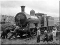
Steam locomotive in Waterside station - 1979 (4)
As the site of Waterside's turntable is now believed buried under a ring-road, ex-GS&WR No. 186 was probably the last locomotive to use this once useful facility.
Image: © The Carlisle Kid
Taken: 1 Sep 1979
0.04 miles
5
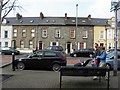
Terraced houses, Derry / Londonderry
Pictured at Clooney Terrace
Image: © Kenneth Allen
Taken: 9 Apr 2010
0.04 miles
6
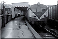
The original Waterside station, Londonderry
One of the two platforms of the original Waterside Station, Londonderry the outside of which is shown in Image and the trackside view in Image Now replaced by a utilitarian structure Image Note the wagons (right) with containers Image The train is the 14.55 to Belfast York Road composed of 70-class railcars.
Image: © Albert Bridge
Taken: 9 Feb 1974
0.04 miles
7
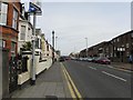
Clooney Terrace, Derry / Londonderry
Looking north
Image: © Kenneth Allen
Taken: 9 Apr 2010
0.05 miles
8
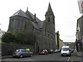
Rear of All Saints Church, Derry / Londonderry
This is the rear view of the church pictured from Bonds Hill, the front view is here Image]
Image: © Kenneth Allen
Taken: 9 Apr 2010
0.05 miles
9
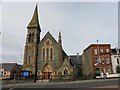
Waterside Presbyterian Church
It is located at the junction of Simpsons Brae and Clooney Terrace; to the left is the old Clooney School Image]
Image: © Kenneth Allen
Taken: 9 Apr 2010
0.05 miles
10
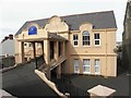
Sikh Cultural Centre, Derry / Londonderry
Located at Simpsons Brae, it was the former Clooney Primary School which was built in 1815.
Image: © Kenneth Allen
Taken: 9 Apr 2010
0.06 miles