
IMAGES TAKEN NEAR TO
Palmerston Park, LONDONDERRY, BT47 6DJ
Introduction
This page details the photographs taken nearby to Palmerston Park, BT47 6DJ by members of the Geograph project.
The Geograph project started in 2005 with the aim of publishing, organising and preserving representative images for every square kilometre of Great Britain, Ireland and the Isle of Man.

There are currently over 7.5m images from over14,400 individuals and you can help contribute to the project by visiting https://www.geograph.org.uk
Image Map
Images are licensed for reuse under creativecommons.org/licenses/by-sa/2.0
Notes
- Clicking on the map will re-center to the selected point.
- The higher the marker number, the further away the image location is from the centre of the postcode.
Image Listing (11 Images Found)
Images are licensed for reuse under creativecommons.org/licenses/by-sa/2.0
Image
Details
Distance

4

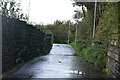
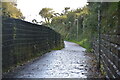
Boathouse on the edge of the River Foyle 1960ish
Taken by my late father whilst he was photographing a squall - see previous image
Image: © Tony Whelan (Deceased)
Taken: Unknown
0.16 miles
5
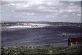
Squall on the River Foyle from Caw Park
Taken by my late father, it would appear this is a squall that kicked up a lot of spray as there are quite a few photos of it going from this at its peak. We were living in Caw Park at stage in the early 1960s just after I was born.
This is all a guess, but it appears the base of the boathouse is still visible in aerial images, and I suspect the line wires in the foreground are on the railway.
Image: © Tony Whelan (Deceased)
Taken: Unknown
0.17 miles
7
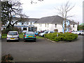
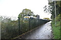
Broomhill Hotel, Derry / Londerry
It is located on the north end of the Waterside district of the city
Image: © Kenneth Allen
Taken: 23 Mar 2006
0.20 miles
8

Boundary Post, Derry~Londonderry
An old boundary post on the Limavady Road. It is marked
"CITY BOUNDARY
1864."
I believe that it was manufactured by Coppin's on the Strand Road in the city (see https://apps.communities-ni.gov.uk/Buildings/buildview.aspx?id=20043&js=false ).
Image: © Rossographer
Taken: 9 Apr 2026
0.21 miles
10

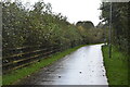
Lane, Derry~Londonderry
Unnamed lane off the A2 Limavady Road in the city. There is a flush bracket bench mark located on the house on the left Image
Image: © Rossographer
Taken: 9 Apr 2026
0.22 miles