IMAGES TAKEN NEAR TO
Barr Cregg, LONDONDERRY, BT47 4DT
Introduction
This page details the photographs taken nearby to Barr Cregg, BT47 4DT by members of the Geograph project.
The Geograph project started in 2005 with the aim of publishing, organising and preserving representative images for every square kilometre of Great Britain, Ireland and the Isle of Man.

There are currently over 7.5m images from over14,400 individuals and you can help contribute to the project by visiting https://www.geograph.org.uk
Image Map
Images are licensed for reuse under creativecommons.org/licenses/by-sa/2.0
Notes
- Clicking on the map will re-center to the selected point.
- The higher the marker number, the further away the image location is from the centre of the postcode.
Image Listing (17 Images Found)
Images are licensed for reuse under creativecommons.org/licenses/by-sa/2.0
Image
Details
Distance
1
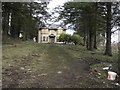
Parochial House, Claudy
It is in derelict condition
Image: © Kenneth Allen
Taken: 19 Jan 2010
0.07 miles
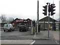
2
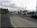
B74 Glenshane Road, Claudy
Heading east towards Main Street
Image: © Kenneth Allen
Taken: 19 Jan 2010
0.13 miles
3
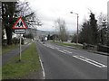
Main Street, Claudy
Heading east towards the village centre
Image: © Kenneth Allen
Taken: 19 Jan 2010
0.14 miles
4
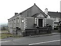
St Patrick's Hall, Claudy
Built in 1914, it is located along Main Street
Image: © Kenneth Allen
Taken: 19 Jan 2010
0.15 miles
5
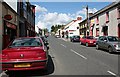
Claudy
The main street of the village.
Image: © Anne Burgess
Taken: 30 May 2007
0.17 miles
6

Main Street, Claudy
Heading WNW towards the Glenshane Road
Image: © Kenneth Allen
Taken: 19 Jan 2010
0.17 miles
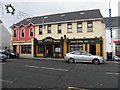
7
Burkes Takeaway, Claudy
It is located at Main Street
Image: © Kenneth Allen
Taken: 19 Jan 2010
0.19 miles
8
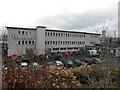
St Patricks & St Brigid's College, Claudy
It is located along Main Street
Image: © Kenneth Allen
Taken: 19 Jan 2010
0.19 miles
9
Dan's Public Bar, Claudy
It is located at Main Street
Image: © Kenneth Allen
Taken: 19 Jan 2010
0.23 miles
10
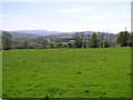
Cregg Townland
It is to the west of Claudy village
Image: © Kenneth Allen
Taken: 1 May 2007
0.23 miles