
IMAGES TAKEN NEAR TO
Church Road, LONDONDERRY, BT47 3SE
Introduction
This page details the photographs taken nearby to Church Road, BT47 3SE by members of the Geograph project.
The Geograph project started in 2005 with the aim of publishing, organising and preserving representative images for every square kilometre of Great Britain, Ireland and the Isle of Man.

There are currently over 7.5m images from over14,400 individuals and you can help contribute to the project by visiting https://www.geograph.org.uk
Image Map
Images are licensed for reuse under creativecommons.org/licenses/by-sa/2.0
Notes
- Clicking on the map will re-center to the selected point.
- The higher the marker number, the further away the image location is from the centre of the postcode.
Image Listing (5 Images Found)
Images are licensed for reuse under creativecommons.org/licenses/by-sa/2.0
Image
Details
Distance
1
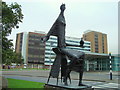
Princess Macha at Altnagelvin Hospital
At the entrance of the hospital, as sculpted by F.E Mc William, Macha was said to have founded the earliest hospital in Ireland (300BC). The statue is currently on loan to a gallery in Banbridge, as the centre piece of an exhibition celebrating the life and work of one of Ireland's most influential sculptors, affectionately known as Mac.
Altnagelvin means 'high place of the birds' in Irish.
Image: © louise price
Taken: 28 Aug 2008
0.07 miles
2
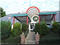
Veterinary clinic Drumahoe
Modern veterinary clinic kept very busy in Drumahoe.
Image: © Kay Atherton
Taken: 28 Jul 2008
0.12 miles
3
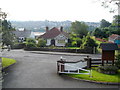
Village of Drumahoe
What looks like an expanse of water behind the houses is actually a very large concrete area where some factories were demolished.
Image: © Kay Atherton
Taken: 28 Jul 2008
0.12 miles
4
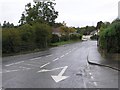
Church Brae, Derry / Londonderry
Looking north towards Altnagelvin
Image: © Kenneth Allen
Taken: 11 Oct 2006
0.23 miles
5
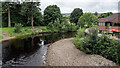
The River Faughan
The River Faughan as viewed from the Drumahoe Road bridge.
Image: © Rossographer
Taken: 15 Aug 2023
0.23 miles