IMAGES TAKEN NEAR TO
Hammond Mews, MAGHERAFELT, BT45 7PU
Introduction
This page details the photographs taken nearby to Hammond Mews, BT45 7PU by members of the Geograph project.
The Geograph project started in 2005 with the aim of publishing, organising and preserving representative images for every square kilometre of Great Britain, Ireland and the Isle of Man.

There are currently over 7.5m images from over14,400 individuals and you can help contribute to the project by visiting https://www.geograph.org.uk
Image Map
Images are licensed for reuse under creativecommons.org/licenses/by-sa/2.0
Notes
- Clicking on the map will re-center to the selected point.
- The higher the marker number, the further away the image location is from the centre of the postcode.
Image Listing (113 Images Found)
Images are licensed for reuse under creativecommons.org/licenses/by-sa/2.0
Image
Details
Distance
1
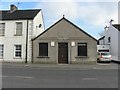
Moneymore Gospel Hall
It is located in Bridger Street.
Image: © Kenneth Allen
Taken: 7 Mar 2011
0.02 miles
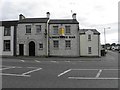
2
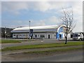
Moneymore Recreation Centre
It is located along Moneyhaw Road
Image: © Kenneth Allen
Taken: 7 Mar 2011
0.02 miles
3
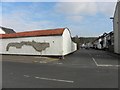
Shed, Moneymore
It is located at the junction of Bridger Street and Hammond Street
Image: © Kenneth Allen
Taken: 7 Mar 2011
0.03 miles
4
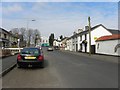
Bridger Street, Moneymore
Heading north towards Cookstown Road
Image: © Kenneth Allen
Taken: 7 Mar 2011
0.04 miles
5
Hair Shop, Moneymore
It is located at Cookstown Road
Image: © Kenneth Allen
Taken: 21 Mar 2011
0.07 miles
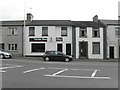
6
Limestone Bar, Moneymore
It is located at the corner of Cookstown Road and Bridger Street
Image: © Kenneth Allen
Taken: 21 Mar 2011
0.07 miles
7
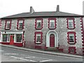
Limestone buildings, Moneymore
They are located at Cookstown Road.
Image: © Kenneth Allen
Taken: 21 Mar 2011
0.07 miles
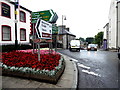
9
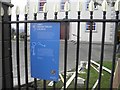
Information, First Presbyterian Church, Moneymore
It is one of several, located round the village, to explain the historic buildings
Here for example, it says, "Situated on its original site this listed building was built by the Drapers Company of London and designed lo the approval of Jesse Gibson by George Bridger in 1823, The foundation stone was laid in 1811 and commemorates two significant gentlemen of that time. Nathaniel Stonard and William Hammond, Stonard Street and Hammond Street in the village were named in their memory" There is also a Bridger Street which is off Cookstown Road.
It is located here Image]
Image: © Kenneth Allen
Taken: 21 Mar 2011
0.09 miles
10
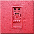
Flush Bracket, Moneymore
Flush bracket bench mark on the bottom right hand side of the front of Moneymore Orange Hall Image It is on the primary levelling line between Magherafelt and Armagh.
The number on the bracket is OSBM 3289.
The mark has been levelled to 48.66 metres above MSL.
Image: © Rossographer
Taken: 12 Jun 2014
0.09 miles