
IMAGES TAKEN NEAR TO
Riverbrook Drive, MAGHERAFELT, BT45 7GA
Introduction
This page details the photographs taken nearby to Riverbrook Drive, BT45 7GA by members of the Geograph project.
The Geograph project started in 2005 with the aim of publishing, organising and preserving representative images for every square kilometre of Great Britain, Ireland and the Isle of Man.

There are currently over 7.5m images from over14,400 individuals and you can help contribute to the project by visiting https://www.geograph.org.uk
Image Map
Images are licensed for reuse under creativecommons.org/licenses/by-sa/2.0
Notes
- Clicking on the map will re-center to the selected point.
- The higher the marker number, the further away the image location is from the centre of the postcode.
Image Listing (77 Images Found)
Images are licensed for reuse under creativecommons.org/licenses/by-sa/2.0
Image
Details
Distance
1
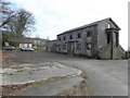
The Common Barn, Moneymore
The Barn building was erected c.1840 - 1843 and used as a store. It was owned by the London Drapers' Company and rented out as a communal store to locals until the early 19005.
In the fifties Ceilidh dancing was a major form of entertainment and for the people of Moneymore, their ballroom was 'The Barn'. It is located off Springhill Road
Image: © Kenneth Allen
Taken: 7 Mar 2011
0.12 miles
2
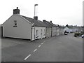
Hammond Street, Moneymore
Looking WSW; most of the walls on the buildings have been plastered over, but the second property still had the original limestone blocked-wall finish.
Image: © Kenneth Allen
Taken: 7 Mar 2011
0.12 miles
3
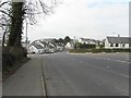
Springhill Road, Moneymore
Heading WNWt towards the village centre
Hammond Street is to the left and Circular Road is on the right
Image: © Kenneth Allen
Taken: 7 Mar 2011
0.13 miles
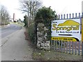
5
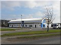
Moneymore Recreation Centre
It is located along Moneyhaw Road
Image: © Kenneth Allen
Taken: 7 Mar 2011
0.14 miles
6
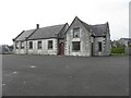
Former school, Moneymore
It is located along Circular Road
Image: © Kenneth Allen
Taken: 7 Mar 2011
0.15 miles
7
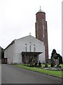
Moneymore RC Church
A church with a tall spire.
Image: © Kenneth Allen
Taken: 26 Aug 2006
0.15 miles
8
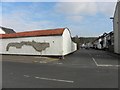
Shed, Moneymore
It is located at the junction of Bridger Street and Hammond Street
Image: © Kenneth Allen
Taken: 7 Mar 2011
0.15 miles
9
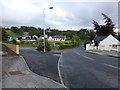
Conyngham Street, Moneymore
Heading south-west from High Street
The spire of the RC Church can be seen in the distance Image]
Image: © Kenneth Allen
Taken: 30 Aug 2014
0.16 miles
10
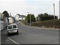
Springhill Road, Moneymore
Heading north-west towards the village centre
Image: © Kenneth Allen
Taken: 7 Mar 2011
0.16 miles