IMAGES TAKEN NEAR TO
Middlepark Road, BALLYMENA, BT44 0SH

Introduction

This page details the photographs taken nearby to Middlepark Road, BT44 0SH by members of the Geograph project.

The Geograph project started in 2005 with the aim of publishing, organising and preserving representative images for every square kilometre of Great Britain, Ireland and the Isle of Man.

There are currently over 7.5m images from over14,400 individuals and you can help contribute to the project by visiting https://www.geograph.org.uk

Image Map


Images are licensed for reuse under creativecommons.org/licenses/by-sa/2.0
Notes
  • Clicking on the map will re-center to the selected point.
  • The higher the marker number, the further away the image location is from the centre of the postcode.

Image Listing (4 Images Found)

Images are licensed for reuse under creativecommons.org/licenses/by-sa/2.0
Image
Details
Distance
1
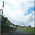
View west along Middle Park Road, Cushendall
The slope of Lurigethan Mountain can be seen on the left.
Image: © Eric Jones Taken: 13 Aug 2011
0.07 miles
2
Waterfoot walled in caves
I wonder what the history of these walled in caves on the Glenariffe Road at Waterfoot is.
Image: © Jude Byrne Taken: 11 Nov 2012
0.23 miles
3
The ruins of Red Bay Castle
There has been a series of castles on this site since the 12thC. The sorry state of the present castle can be blamed squarely on Oliver Cromwell. http://www.castles.nl/eur/ie/rb/rb.html
Image: © Eric Jones Taken: 13 Aug 2011
0.25 miles
4
Antrim Coast at Red Bay
Waterfoot is a small village on the Antrim coast which has a 1 mile-long beach at Red Bay, named from the reddish sand that washes from the exposed sandstone on the cliffs down to the shore. The village is at the foot of Glenariff, one of the Glens of Antrim (the village is also known as Glenariff). The 2001 Census recorded a population of 504 inhabitants (Wikipedia).
Image: © David Dixon Taken: 28 Sep 2017
0.25 miles