
IMAGES TAKEN NEAR TO
Knocklofty Court, BELFAST, BT4 3NF
Introduction
This page details the photographs taken nearby to Knocklofty Court, BT4 3NF by members of the Geograph project.
The Geograph project started in 2005 with the aim of publishing, organising and preserving representative images for every square kilometre of Great Britain, Ireland and the Isle of Man.

There are currently over 7.5m images from over14,400 individuals and you can help contribute to the project by visiting https://www.geograph.org.uk
Image Map
Images are licensed for reuse under creativecommons.org/licenses/by-sa/2.0
Notes
- Clicking on the map will re-center to the selected point.
- The higher the marker number, the further away the image location is from the centre of the postcode.
Image Listing (115 Images Found)
Images are licensed for reuse under creativecommons.org/licenses/by-sa/2.0
Image
Details
Distance
1

Snow, Belfast (4)
See Image At 10.05 the Wandsworth Road (seen at the Belmont Road end) had a heavy and little-disturbed coating of snow.
Image: © Albert Bridge
Taken: 4 Jan 2008
0.02 miles
2

The Wandsworth Road, Belfast (2013)
The Belmont Road end of the Wandsworth Road Image The apartments are (I think) from the 1990’s. The terraces seem to date from after WW1. Image shows the same part of the road but looking in the other direction.
Image: © Albert Bridge
Taken: 3 Jun 2013
0.02 miles
3

Knocklofty Park, Belfast
Knocklofty Park is road of detached houses. It runs from the Hawthornden Road to the Wandsworth Road (background).
Image: © Albert Bridge
Taken: 3 Mar 2008
0.03 miles
4
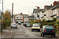
Wandsworth Gardens, Belfast
The view along Wandsworth Gardens, from the Belmont Road end, towards Campbell Park Avenue Image
Image: © Albert Bridge
Taken: 4 Dec 2009
0.04 miles
5

Cherry trees, Belfast
White and pink cherries, in blossom, at the corner of Knocklofty Park (left) and the Wandsworth Road.
Image: © Albert Bridge
Taken: 4 May 2010
0.05 miles
6
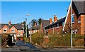
Wandsworth Place, Belfast
Wandsworth Place is a cul-de-sac between the Belmont Church Road and the Wandsworth Road. It was part of a development of some 220 houses built by Belfast Corporation in 1922-24. A masterpiece of planning and design.
Image: © Albert Bridge
Taken: 3 Mar 2008
0.05 miles
7
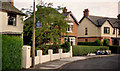
Former Belmont bus terminus, Belfast (1)
The origins of the bus terminus at Belmont Drive Image, a short loop off the Belmont Road, go back to the days of the trolleybuses when it was an intermediate terminus on the Stormont route. By the time of this photograph it had a very limited evening peak service. The stop was blue on this side and read “BUS STOP ALIGHTING ONLY”. The other side was standard red Image Both still bore the letters “BCT” - Belfast Corporation Transport.
Image: © Albert Bridge
Taken: 3 Jun 1990
0.08 miles
8
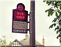
Former Belmont bus terminus, Belfast (2)
See Image The other side (red) of the bus stop sign. The slightly faded lettering reads “BUSES MUST WAIT TILL DEPARTURE TIME ON MAIN ROAD”.
Image: © Albert Bridge
Taken: 3 Jun 1990
0.08 miles
9
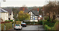
Campbell Park Avenue, Belfast
Campbell Park Avenue starts just off the Belmont Church Road and ends here, at the Wandsworth Road.
Image: © Albert Bridge
Taken: 4 Dec 2009
0.08 miles
10

Drop box, Belfast
A drop box, on a misty Wandsworth Road, close to Campbell Park Avenue. This pillar box Image is in the left background.
Image: © Albert Bridge
Taken: 29 Nov 2012
0.08 miles