
IMAGES TAKEN NEAR TO
Campbell Park Avenue, BELFAST, BT4 3FJ
Introduction
This page details the photographs taken nearby to Campbell Park Avenue, BT4 3FJ by members of the Geograph project.
The Geograph project started in 2005 with the aim of publishing, organising and preserving representative images for every square kilometre of Great Britain, Ireland and the Isle of Man.

There are currently over 7.5m images from over14,400 individuals and you can help contribute to the project by visiting https://www.geograph.org.uk
Image Map
Images are licensed for reuse under creativecommons.org/licenses/by-sa/2.0
Notes
- Clicking on the map will re-center to the selected point.
- The higher the marker number, the further away the image location is from the centre of the postcode.
Image Listing (180 Images Found)
Images are licensed for reuse under creativecommons.org/licenses/by-sa/2.0
Image
Details
Distance
1
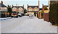
Ardgreenan Gardens, Belfast (2)
See Image Another street with a thick coating of yesterday’s snow.
Image: © Albert Bridge
Taken: 7 Jan 2010
0.06 miles
2
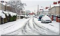
Snow, Belfast (2)
See Image Ardgreenan Drive (at 09.50) seen from the Belmont Church Road.
Image: © Albert Bridge
Taken: 4 Jan 2008
0.06 miles
3
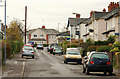
Wandsworth Gardens, Belfast
The view along Wandsworth Gardens, from the Belmont Road end, towards Campbell Park Avenue Image
Image: © Albert Bridge
Taken: 4 Dec 2009
0.06 miles
4

Ardgreenan Gardens, Belfast
The view along Ardgreenan Gardens towards Ardgreenan Drive. Part of a development of some 220 houses built by Belfast Corporation in 1922-24. A masterpiece of planning and design.
Image: © Albert Bridge
Taken: 4 Dec 2009
0.06 miles
5
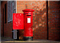
Pillar box, Belfast
EIIR pillar box, on the Belmont Church Road, at the corner of Campbell Park Avenue, outside the former Belmont post office (closed in the last round of closures).
Image: © Albert Bridge
Taken: 25 Feb 2011
0.06 miles
6

Snow, Belfast (4)
See Image At 10.05 the Wandsworth Road (seen at the Belmont Road end) had a heavy and little-disturbed coating of snow.
Image: © Albert Bridge
Taken: 4 Jan 2008
0.07 miles
7

The Belmont Church Road, Belfast
The Belmont Church Road runs from the Upper Newtownards Road across the Belmont Road to Sydenham Avenue Image This is view from the corner of Kincora Avenue Image towards the Belmont Road Image It still has a mini-mart and a bakery. The grocery and wool shops have been re-incorporated into their respective houses. The Post Office is closed and vacant. Continue to Image
Image: © Albert Bridge
Taken: 11 Mar 2008
0.09 miles
8

Ashbourne Court, Belfast
A mid-1980’s development of townhouses and apartments, facing the Belmont Road, centred around a courtyard. Advertised, at the time of construction (if my memory is correct), as being built in the “Queen Anne style”. Not shown on the Google map.
Image: © Albert Bridge
Taken: 29 Jun 2013
0.09 miles
9
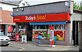
The Belmont minimart, Belfast
The Belmont mini mart, a convenience shop at the Belmont Road end of the Belmont Church Road, now in its latest guise as a “Today’s Local”.
Image: © Albert Bridge
Taken: 12 Jul 2013
0.09 miles
10
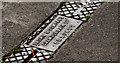
Browns drain cover, Belfast (2)
See Image Another drain cover from the Chamberlain Street, Belfast foundry of Brown & Company. This one is at the Belmont Church Road end of Belmont Park Image
Image: © Albert Bridge
Taken: 5 Aug 2011
0.09 miles