
IMAGES TAKEN NEAR TO
Oakland Avenue, BELFAST, BT4 3BX
Introduction
This page details the photographs taken nearby to Oakland Avenue, BT4 3BX by members of the Geograph project.
The Geograph project started in 2005 with the aim of publishing, organising and preserving representative images for every square kilometre of Great Britain, Ireland and the Isle of Man.

There are currently over 7.5m images from over14,400 individuals and you can help contribute to the project by visiting https://www.geograph.org.uk
Image Map
Images are licensed for reuse under creativecommons.org/licenses/by-sa/2.0
Notes
- Clicking on the map will re-center to the selected point.
- The higher the marker number, the further away the image location is from the centre of the postcode.
Image Listing (321 Images Found)
Images are licensed for reuse under creativecommons.org/licenses/by-sa/2.0
Image
Details
Distance
1

Irwin Crescent, Belfast
Image: © Albert Bridge
Taken: 20 Aug 2009
0.03 miles
2

Oakland Avenue, Belfast (1)
A street of large terrace houses (similar in appearance to others in the general area) running off the Upper Newtownards Road Image to Dundela Avenue. Built, over a number of years, at the start of the 20th century when cars were a novelty. Now a one-way street (towards the Upper Newtownards Road). Continue to Image
Image: © Albert Bridge
Taken: 17 Jun 2010
0.03 miles
3

Oakland Avenue, Belfast (2)
See Image The view in the other direction (towards the Upper Newtownards Road Image) with Clanroy Parade Image in the foreground.
Image: © Albert Bridge
Taken: 17 Jun 2010
0.04 miles
4

Irwin Drive, Belfast
A street of semis off Irwin Avenue Image
Image: © Albert Bridge
Taken: 20 Aug 2009
0.06 miles
5
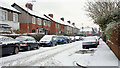
Clanroy Parade, Belfast (2)
See Image The view in the same direction, from Oakland Avenue with Ebrington Gardens Image at the hedge (middle right). Like just about everywhere today - covered by snow.
Image: © Albert Bridge
Taken: 9 Jan 2010
0.07 miles
6

Ebrington Gardens, Belfast (1)
A street running north off the Upper Newtownards Road. The first houses were built in the very early part of the 20th century – the rest came along later. See also Image
Image: © Albert Bridge
Taken: 25 Nov 2009
0.07 miles
7

Clonlee Drive, Belfast
Quiet residential street off the Upper Newtownards Road in east Belfast.
Image: © Rossographer
Taken: 10 Jul 2008
0.08 miles
8
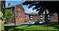
Dundela Flats, Belfast
A small cul-de-sac of flats, off Dundela Avenue, built on the site of Dundela Villas - the birthplace of CS Lewis Image
Image: © Albert Bridge
Taken: 5 Jul 2011
0.08 miles
9

Traffic counter, east Belfast
Solar-powered traffic counter on the Upper Newtownards Road, just down from Oakland Avenue.
Image: © Albert Bridge
Taken: 28 Mar 2011
0.09 miles
10
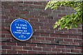
C S Lewis plaque, Belfast
See Image This plaque, in Dundela Avenue, near the North Road, marks the site of the birthplace of CS Lewis. There is no trace of the house. The site is now occupied by Dundela Flats Image See http://www.ulsterhistory.co.uk/cslewis.htm. For the next step in the CS Lewis trail continue to Image See also Image
Image: © Albert Bridge
Taken: 30 May 2007
0.09 miles