
IMAGES TAKEN NEAR TO
Deerfin Way, BALLYMENA, BT43 6HF
Introduction
This page details the photographs taken nearby to Deerfin Way, BT43 6HF by members of the Geograph project.
The Geograph project started in 2005 with the aim of publishing, organising and preserving representative images for every square kilometre of Great Britain, Ireland and the Isle of Man.

There are currently over 7.5m images from over14,400 individuals and you can help contribute to the project by visiting https://www.geograph.org.uk
Image Map
Images are licensed for reuse under creativecommons.org/licenses/by-sa/2.0
Notes
- Clicking on the map will re-center to the selected point.
- The higher the marker number, the further away the image location is from the centre of the postcode.
Image Listing (9 Images Found)
Images are licensed for reuse under creativecommons.org/licenses/by-sa/2.0
Image
Details
Distance
1
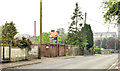
Development site, Cushendall Road, Ballymena (May 2014)
A large and vacant development site, on the western side of the Cushendall Road, at the corner of Deerfin Way. The agents’ board has a “sold” patch. The Braid Valley Hospital is in the background.
Image: © Albert Bridge
Taken: 20 May 2014
0.06 miles
2
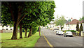
Greenview, Ballymena
Semi-detached houses overlooking a green bordered by mature trees. (Green View on the Google map).
Image: © Albert Bridge
Taken: 20 May 2014
0.07 miles
3
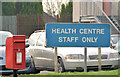
Letter box, Ballymena
Post-mounted EIIR letter box (BT43 25), at the Health Centre and Braid Valley Hospital, on the Cushendall Road.
Image: © Albert Bridge
Taken: 10 Jan 2013
0.12 miles
4
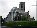
All Saints' Catholic Church, Ballymena
All Saints' Catholic Church, one of the seven towers of Ballymena is at the top of the town, at the corner of Cushendall Road and Broughshane Road. It was built in 1860 and the tower was completed around the 1900s.
Image: © Lisa Jarvis
Taken: 17 Aug 2007
0.13 miles
5
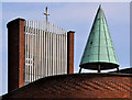
High Kirk Presbyterian church, Ballymena (detail)
See Image Part of the church seen from Thomas Street.
Image: © Albert Bridge
Taken: 30 Apr 2011
0.20 miles
6
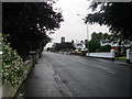
Broughshane Road, Ballymena
View back into Ballymena Town. All Saints' Catholic Church, one of the seven towers of Ballymena can be seen, built in 1860 at the corner of Cushendall Road and Broughshane Road. The tower was completed around the 1900s.
Image: © Lisa Jarvis
Taken: 17 Aug 2007
0.22 miles
7
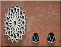
Windows, High Kirk Presbyterian Church
In 1769 Scottish preachers established preaching stations on the outskirts of Ballymena and moved into Ballymena in 1822. The initial church was outgrown and was replaced by a new church in High Street in 1892. In 1968 agreement was reached with the Development Commission to vacate the High Street site due to development of the town centre.
The church is now located on Thomas Road. Work began at this location in 1973 and the church was opened in September 1976. The Church is known as High Kirk after the street where the congregation were based for most of their history.
Image: © Lisa Jarvis
Taken: 15 Aug 2007
0.22 miles
8
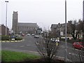
Ballymena, County Antrim
This is the main town of the district.
Image: © Kenneth Allen
Taken: 17 Feb 2007
0.22 miles
9
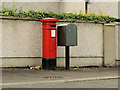
Pillar box and drop box, Ballymena
Drop box and EVIIR pillar box (BT43 5) at Summerfield.
Image: © Albert Bridge
Taken: 15 Aug 2012
0.23 miles