IMAGES TAKEN NEAR TO
Linenhall Street, BALLYMENA, BT43 5AJ

Introduction

This page details the photographs taken nearby to Linenhall Street, BT43 5AJ by members of the Geograph project.

The Geograph project started in 2005 with the aim of publishing, organising and preserving representative images for every square kilometre of Great Britain, Ireland and the Isle of Man.

There are currently over 7.5m images from over14,400 individuals and you can help contribute to the project by visiting https://www.geograph.org.uk

Image Map


Images are licensed for reuse under creativecommons.org/licenses/by-sa/2.0
Notes
  • Clicking on the map will re-center to the selected point.
  • The higher the marker number, the further away the image location is from the centre of the postcode.

Image Listing (84 Images Found)

Images are licensed for reuse under creativecommons.org/licenses/by-sa/2.0
  • ...
Image
Details
Distance
1
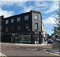
Former "Linenhall Bar", Ballymena (July 2014)
The closed and semi-derelict Linenhall Bar at 34-36 Linenhall Street. The former “Moore’s” Image is on the left.
Image: © Albert Bridge Taken: 3 Jul 2014
0.01 miles
2
Former A Moore & Sons, Ballymena (July 2014)
A long-established business, at 26-32 Linenhall Street, which closed in 2005 to make way for a new development which was never built. Note the old “Raleigh Cycles” sign on the first floor. The former “Linenhall Bar” Image is next right.
Image: © Albert Bridge Taken: 3 Jul 2014
0.02 miles
3
Ballymena Town Hall
The Town Hall stands on the site of the Old Market Hall, burned down in the rebellion of 1798. It stages many cultural events including the annual Arts Festival, alongside its civic duties.
Image: © Lisa Jarvis Taken: 15 Aug 2007
0.03 miles
4
"The Braid", Ballymena
“The Braid” opened in 2008. A new building, designed by the Consarc Design Group, grafted onto the former Town Hall Image (just visible behind the trees on the right), it “weaves together history, arts and culture alongside contemporary conference, tourism and civic facilities”.
Image: © Albert Bridge Taken: 2 Aug 2012
0.04 miles
5
Former bank and Crown Buildings, Ballymena
The building seen from Pat’s Brae. It was previously the offices of the District Valuer. The agent (see the shared description below) uses the numbering 2-14 which also includes a more recent building – just visible at middle right. The Google map shows this as Linenhall Street.
Image: © Albert Bridge Taken: 10 Jan 2013
0.05 miles
6
Bank initials, Ballymena
The initials above the door of the former Northern Bank at George Street. For something similar see Image and Image
Image: © Albert Bridge Taken: 10 Jan 2013
0.05 miles
7
Gas works plaque, Ballymena
A plaque, opposite here Image, marking the site of the old gas works https://www.facebook.com/Oldphotosballymena/photos/a.335399769916195.1073741831.254410138015159/295549703901202/?type=1.
Image: © Albert Bridge Taken: 13 Jun 2014
0.05 miles
8
Chevrolet pick-up truck, Ballymena
A metallic blue Chevrolet pick-up truck parked in Lower Mill Street. Intended (I think) as advertising, the model might be a “Task Force” http://en.wikipedia.org/wiki/Chevrolet_Task_Force and http://classicchevytrucks.org/task-force-1955-59/.
Image: © Albert Bridge Taken: 3 Jul 2014
0.05 miles
9
1933 building on the corner of Wellington Street and Mill Street
It has previously been a Mortgage Advice Shop and an estate agents. Now it is Studio 16 tattoo and piercing studio.
Image: © Gerald England Taken: 13 Sep 2020
0.05 miles
10
Doorway and fanlight detail, Ballymena
Doorway and fanlight detail at the former Northern Bank, George Street.
Image: © Albert Bridge Taken: 10 Jan 2013
0.05 miles
  • ...