
IMAGES TAKEN NEAR TO
Cairnburn Road, BELFAST, BT4 2PF
Introduction
This page details the photographs taken nearby to Cairnburn Road, BT4 2PF by members of the Geograph project.
The Geograph project started in 2005 with the aim of publishing, organising and preserving representative images for every square kilometre of Great Britain, Ireland and the Isle of Man.

There are currently over 7.5m images from over14,400 individuals and you can help contribute to the project by visiting https://www.geograph.org.uk
Image Map
Images are licensed for reuse under creativecommons.org/licenses/by-sa/2.0
Notes
- Clicking on the map will re-center to the selected point.
- The higher the marker number, the further away the image location is from the centre of the postcode.
Image Listing (102 Images Found)
Images are licensed for reuse under creativecommons.org/licenses/by-sa/2.0
Image
Details
Distance
1
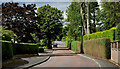
The Cairnburn Road, Belfast (3)
The Cairnburn Road, from the corner of Cairnburn Drive, looking down to the Old Holywood Road.
Image: © Albert Bridge
Taken: 22 Jul 2011
0.02 miles
2
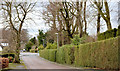
The Cairnburn Road, Belfast (February 2014)
The Cairnburn Road descending towards the Old Holywood Road Image The junction there was realigned to make it a staggered crossroads. The Cairnburn Road now curves to the right instead of going straight across.
Image: © Albert Bridge
Taken: 25 Feb 2014
0.03 miles
3
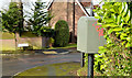
Drop box, Glenmachan, Belfast
A drop box, on the Cairnburn Road, at the corner of Glenmachan Drive.
Image: © Albert Bridge
Taken: 25 Feb 2014
0.05 miles
4

The Old Holywood Road, Belfast (3)
See Image The Old Holywood Road (right) beyond the Cairnburn Road. The previous line (still called the Old Holywood Road) runs between the trees at middle left.
Image: © Albert Bridge
Taken: 8 Dec 2010
0.05 miles
5
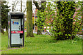
Telephone box, Belfast (2)
A working telephone box, between the Old Holywood Road Image (out of picture to the left) and the old Old Holywood Road, near the Cairnburn Road.
Image: © Albert Bridge
Taken: 13 Apr 2011
0.07 miles
6
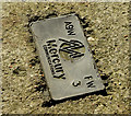
Mercury access cover, Belfast (October 2015)
A plate attached to a concrete access cover on the Old Holywood Road. The numbers and letters provided information for Mercury employees but are meaningless to the rest of us.
Image: © Albert Bridge
Taken: 29 Oct 2015
0.07 miles
7

Pillar box, Belfast
The EIIR pillar box, previously seen in the snow in Image, from a different viewpoint and with the spring leaves appearing.
Image: © Albert Bridge
Taken: 13 Apr 2011
0.07 miles
8

Pillar box, Belfast
EIIR pillar box on a snow-covered Old Holywood Road – also seen in Image
Image: © Albert Bridge
Taken: 8 Dec 2010
0.07 miles
9

Development site, Old Holywood Road, Belfast (October 2015)
See Image (April 2011). Some 4½ years later this desirable site, on the inward side of Kennelbridge, remains untouched and overgrown.
Image: © Albert Bridge
Taken: 29 Oct 2015
0.09 miles
10
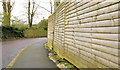
Suburban fences, Belfast
Two wooden suburban fences, on the Cairnburn Road, close to the corner of the Glenmachan Road.
Image: © Albert Bridge
Taken: 25 Feb 2014
0.09 miles