
IMAGES TAKEN NEAR TO
Belmont Road, BELFAST, BT4 2NF
Introduction
This page details the photographs taken nearby to Belmont Road, BT4 2NF by members of the Geograph project.
The Geograph project started in 2005 with the aim of publishing, organising and preserving representative images for every square kilometre of Great Britain, Ireland and the Isle of Man.

There are currently over 7.5m images from over14,400 individuals and you can help contribute to the project by visiting https://www.geograph.org.uk
Image Map
Images are licensed for reuse under creativecommons.org/licenses/by-sa/2.0
Notes
- Clicking on the map will re-center to the selected point.
- The higher the marker number, the further away the image location is from the centre of the postcode.
Image Listing (62 Images Found)
Images are licensed for reuse under creativecommons.org/licenses/by-sa/2.0
Image
Details
Distance
1
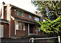
No 305 Belmont Road, Belfast
Another of the many large and vacant houses, pending development, around Belmont, Stormont and Knock. This one fronts the Belmont Road just past Tweskard Park. This photograph appears as a matter of record only. I have no connection with any of the parties involved in the development. See also Image (June 2013).
Image: © Albert Bridge
Taken: 26 Oct 2011
0.03 miles
2

No 305 Belmont Road, Belfast (2)
The remains of the former 305 seen from the Belmont Road.
Image: © Albert Bridge
Taken: 23 Nov 2013
0.04 miles
3

Field and trees, Belfast
Part of large field, between the Glenmachan and Belmont Roads, seen from here Image
Image: © Albert Bridge
Taken: 26 Oct 2011
0.06 miles
4

No 303 Belmont Road, Belfast (2)
The site of the former 303 seen from the Glenmachan Road.
Image: © Albert Bridge
Taken: 23 Nov 2013
0.06 miles
5

No 303 Belmont Road, Belfast (3)
The site of the former 303 seen from the Belmont Road.
Image: © Albert Bridge
Taken: 23 Nov 2013
0.06 miles
6

Glenmachan Road sign, Belfast (2)
See Image The modern style of sign, on the old post, at the Belmont Road end of the Glenmachan Road (eastern side).
Image: © Albert Bridge
Taken: 12 Apr 2011
0.06 miles
7

Glenmachan Road sign, Belfast (1)
Old tiled sign at the Belmont Road end of the Glenmachan Road (western side). See also Image
Image: © Albert Bridge
Taken: 12 Apr 2011
0.07 miles
8

Tweskard Park, Belfast
A loop of detached houses on the eastern/south eastern side of the Belmont Road. The name seems to have come from “Tweskard”, a house near “Netherleigh” Image once occupied by Thomas Greeves, a director of J&TM Greeves’ Forthriver Mill.
Image: © Albert Bridge
Taken: 24 Jun 2013
0.07 miles
9

Fairythorn, Belfast
Image: © Albert Bridge
Taken: 26 Oct 2011
0.09 miles
10

The Glen Road, Belfast (1)
There are three “Glen Roads” in Belfast – Andersonstown, Castlereagh and this one off the Belmont Road (background). Now just a track and still paved with a surface which might have been laid before the invention of the motor car. It leads around part of the former Glenmachan estate. There is no physical barrier across the road. There are council signs warning against dumping. Notwithstanding that, there is a possibility that I might have trespassed and, as a consequence, render myself liable for transportation to the Colonies. If you find this photograph unacceptable just ask for its removal.
For the record the draft Belfast Metropolitan Area Plan (2015) describes the area as follows “Scattered small glens with mixed woodland and broad-leaved plantation. Woodland mainly, Beech (Fagus sylvatica), Scot's pine (Pinus sylvestris) and Pedunculate oak (Quercus robur). The glens provide good wildlife corridors.“
Image: © Albert Bridge
Taken: 26 Oct 2011
0.11 miles