
IMAGES TAKEN NEAR TO
Dehra Grove, BELFAST, BT4 2DW
Introduction
This page details the photographs taken nearby to Dehra Grove, BT4 2DW by members of the Geograph project.
The Geograph project started in 2005 with the aim of publishing, organising and preserving representative images for every square kilometre of Great Britain, Ireland and the Isle of Man.

There are currently over 7.5m images from over14,400 individuals and you can help contribute to the project by visiting https://www.geograph.org.uk
Image Map
Images are licensed for reuse under creativecommons.org/licenses/by-sa/2.0
Notes
- Clicking on the map will re-center to the selected point.
- The higher the marker number, the further away the image location is from the centre of the postcode.
Image Listing (270 Images Found)
Images are licensed for reuse under creativecommons.org/licenses/by-sa/2.0
Image
Details
Distance
1

Dehra Grove, Belfast
A small cul-de-sac, in a pleasant setting, off Sydenham Avenue. Built in the 1950’s and taking its name from the Victorian “Dehra Lodge” which once occupied the site.
Image: © Albert Bridge
Taken: 4 Dec 2009
0.02 miles
2

Sycamore Grove, Belfast
Small cul-de-sac of town houses (off Sydenham Avenue) built in the mid/late 1980’s. Completely forgotten what was here before but I was surprised that some trees were retained.
Image: © Albert Bridge
Taken: 25 Nov 2009
0.03 miles
3

Edenvale Park, Belfast
See Image Edenvale Park is another part of the former Edenvale estate.
Image: © Albert Bridge
Taken: 29 Jun 2009
0.04 miles
4

Mobile library, Belfast
At Sycamore Grove Image off Sydenham Avenue.
Image: © Albert Bridge
Taken: 15 Apr 2010
0.04 miles
5
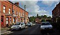
Bathgate Drive, Belfast (2)
See Image The view in the other direction – towards Edenvale Drive with the spire of St Mark’s, Dundela Image in the background.
Image: © Albert Bridge
Taken: 5 Aug 2011
0.04 miles
6

Edenvale Park sign, Belfast
Traditional tiled sign, mounted on a concrete post, at the Edenvale Drive end of Edenvale Park.
Image: © Albert Bridge
Taken: 25 Feb 2011
0.05 miles
7

Belmont Mews signs, Belfast
Two signs at Belmont Mews, Sydenham Avenue Image – the standard council one and the builder’s ornamental version.
Image: © Albert Bridge
Taken: 5 Aug 2011
0.05 miles
8
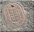
Ford water meter cover, Belfast (January 2015)
A Ford (Wabash, Indiana) water meter cover at the Holywood Road end of Sydenham Avenue Image For other Ford covers see http://www.geograph.org.uk/of/Wabash.
Image: © Albert Bridge
Taken: 29 Jan 2015
0.06 miles
9

The Holywood Road, Belfast (2)
See Image The Holywood Road varies considerably, in appearance and character, along its length from The Arches Image to Tillysburn Image This tree-lined section is near Sydenham Park Image Continue to Image
Image: © Albert Bridge
Taken: 17 Jun 2010
0.06 miles
10

Sydenham Park sign, Belfast
Post-mounted tiled sign, under a sodium street light, at the Holywood Road end of Sydenham Park Image The old postal district number has been painted on the post.
Image: © Albert Bridge
Taken: 16 Nov 2010
0.07 miles