
IMAGES TAKEN NEAR TO
Brandra Street, BELFAST, BT4 1JG
Introduction
This page details the photographs taken nearby to Brandra Street, BT4 1JG by members of the Geograph project.
The Geograph project started in 2005 with the aim of publishing, organising and preserving representative images for every square kilometre of Great Britain, Ireland and the Isle of Man.

There are currently over 7.5m images from over14,400 individuals and you can help contribute to the project by visiting https://www.geograph.org.uk
Image Map
Images are licensed for reuse under creativecommons.org/licenses/by-sa/2.0
Notes
- Clicking on the map will re-center to the selected point.
- The higher the marker number, the further away the image location is from the centre of the postcode.
Image Listing (424 Images Found)
Images are licensed for reuse under creativecommons.org/licenses/by-sa/2.0
Image
Details
Distance
1
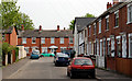
Brandra Street, Belfast
A short street running from Parkgate Avenue to Brandon Parade (background). Many of the surrounding streets are built in the two styles shown, leading me to wonder whether they were originally all speculative builds, for letting, by the same builder.
Image: © Albert Bridge
Taken: 18 Apr 2011
0.03 miles
2

No 4 Brandon Parade, Belfast (March 2016)
A derelict building which was the subject of the following application for planning permission (subsequently withdrawn) on 10 July 2014 “Z/2014/0945/F Proposed new 3 storey dwelling 4 Brandon Parade Belfast BT4 1JH”. Previously seen in Image (September 2014).
Image: © Albert Bridge
Taken: 4 Mar 2016
0.04 miles
3
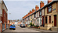
Brandon Terrace, Belfast
A short street, built towards the end of the 19th century, running from Mersey Street to Brandon Parade (background). Modern apartments on the left and the original terrace on the right.
Image: © Albert Bridge
Taken: 15 Apr 2010
0.04 miles
4

Abandoned coal shop Brandon Parade
Former coal shop in East Belfast
The shop has now moved across road
To the left is the remains of Jane's cake shop. The cake shop was once Connsbrook library
Image: © John Thompson
Taken: 3 Sep 2014
0.04 miles
5

New Translink Volvo B5LH
New Belfast Metro double decker fleet
Image: © John Thompson
Taken: 5 Jul 2014
0.04 miles
6
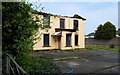
Derelict building, Belfast
Burned out and derelict building opposite the corner of Mersey Street and Parkgate Avenue. Continue to Image (October 2012).
Image: © Albert Bridge
Taken: 18 Apr 2011
0.05 miles
7

"Today's local" shop, Belfast (April 2018)
“The Brook”, a Today’s local corner shop at 72 Connsbrook Avenue. Bandon Parade is on the left. Image on the right. I have no connection with the business.
Image: © Albert Bridge
Taken: 28 Apr 2018
0.05 miles
8

No 74 Connsbrook Avenue, Belfast
Currently vacant shop offered for sale. The agents’ description includes “The property comprises of two shop units fronting onto Connsbrook Avenue with Adjoining access leading to a yard at the rear”. This photograph appears as a matter of record only. I have no connection with any of the parties involved in the sale. No 76 is on the right.
Image: © Albert Bridge
Taken: 15 Oct 2012
0.05 miles
9

Nos 74/78A Connsbrook Avenue, Belfast (April 2018)
Now with a “sale agreed” patch.
Image: © Albert Bridge
Taken: 28 Apr 2018
0.05 miles
10

Harland Park, Belfast
Pleasant street of semis off Parkgate Avenue.
Image: © Albert Bridge
Taken: 15 Apr 2010
0.05 miles