
IMAGES TAKEN NEAR TO
Newtownards Road, BELFAST, BT4 1HB
Introduction
This page details the photographs taken nearby to Newtownards Road, BT4 1HB by members of the Geograph project.
The Geograph project started in 2005 with the aim of publishing, organising and preserving representative images for every square kilometre of Great Britain, Ireland and the Isle of Man.

There are currently over 7.5m images from over14,400 individuals and you can help contribute to the project by visiting https://www.geograph.org.uk
Image Map
Images are licensed for reuse under creativecommons.org/licenses/by-sa/2.0
Notes
- Clicking on the map will re-center to the selected point.
- The higher the marker number, the further away the image location is from the centre of the postcode.
Image Listing (262 Images Found)
Images are licensed for reuse under creativecommons.org/licenses/by-sa/2.0
Image
Details
Distance
1

No 222 Newtownards Road, Belfast (March 2018)
A vacant building, last used as a hardware shop, demolished yesterday. It had this mural Image on the gable.
Image: © Albert Bridge
Taken: 11 Mar 2018
0.01 miles
2
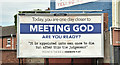
Religious message, Ballymacarett, Belfast (July 2018)
A poster, with a biblical message, at the corner of Chadolly Street and the Newtownards Road. The Bethany chip shop is on the right.
Image: © Albert Bridge
Taken: 27 Jul 2018
0.01 miles
3
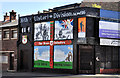
36th (Ulster) Division mural, Ballymacarrett, Belfast
A mural in memory of the 36th (Ulster) Division and the Battle of the Somme. The building has been acquired by the Belfast Regeneration Office and seems likely to be demolished. Image shows a similar mural in Donegall Pass.
A visitor to the site has commented "This is not St. Leonard's Street but newly named St Leonard's Crescent. Was Newcastle Street before that. It was a Hardware shop. On other corner was Belvoir Bar, still there. St Leonard's Street is next Street to left of picture. On corner was launderette which became a chip shop."
Image: © Albert Bridge
Taken: 10 Jun 2012
0.02 miles
4

Former Belvoir Bar, Belfast (March 2018)
See Image (March 2012). Closed but still standing.
Image: © Albert Bridge
Taken: 11 Mar 2018
0.02 miles
5

No 246B Newtownards Road, Belfast (March 2018)
A vacant building at the corner of Derwent Street Image (right).
Image: © Albert Bridge
Taken: 11 Mar 2018
0.02 miles
6
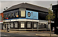
The "Belvoir Bar", Belfast
The “Belvoir” (also “Freddie Crawford’s”) is now closed. Continue to Image
Image: © Albert Bridge
Taken: 11 Mar 2012
0.02 miles
7
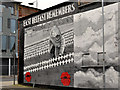
Mural, Ballymacarrett, Belfast (1)
Part of a mural on the western side of Derwent Street. The Skainos Project, on the Newtownards Road, is on the left. This photograph appears as a matter of neutral historical record only and should not be interpreted as expressing any political or sectarian opinion. Image shows the other part of the same mural.
Image: © Albert Bridge
Taken: 11 Mar 2012
0.03 miles
8
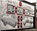
Mural, Ballymacarrett, Belfast (2)
See Image The other part of the same mural. This photograph appears as a matter of neutral historical record only and should not be interpreted as expressing any political or sectarian opinion. Image shows the mural on the eastern side of the same street.
Image: © Albert Bridge
Taken: 11 Mar 2012
0.03 miles
9
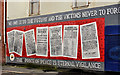
Mural, Ballymacarrett, Belfast (3)
See Image The mural on the eastern side of Derwent Street. This photograph appears as a matter of neutral historical record only and should not be interpreted as expressing any political or sectarian opinion.
Image: © Albert Bridge
Taken: 11 Mar 2012
0.03 miles
10
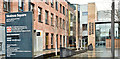
Skainos Square, Belfast (March 2018)
The entrance to the Skainos Centre Image
Image: © Albert Bridge
Taken: 11 Mar 2018
0.03 miles