
IMAGES TAKEN NEAR TO
Millview, ANTRIM, BT41 4QD
Introduction
This page details the photographs taken nearby to Millview, BT41 4QD by members of the Geograph project.
The Geograph project started in 2005 with the aim of publishing, organising and preserving representative images for every square kilometre of Great Britain, Ireland and the Isle of Man.

There are currently over 7.5m images from over14,400 individuals and you can help contribute to the project by visiting https://www.geograph.org.uk
Image Map
Images are licensed for reuse under creativecommons.org/licenses/by-sa/2.0
Notes
- Clicking on the map will re-center to the selected point.
- The higher the marker number, the further away the image location is from the centre of the postcode.
Image Listing (27 Images Found)
Images are licensed for reuse under creativecommons.org/licenses/by-sa/2.0
Image
Details
Distance
1
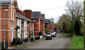
Abbeyview, Muckamore
A row of houses between the Sixmilewater Image and the Seven Mile Straight. Part of Raceview they are (I think) former mill houses.
Image: © Albert Bridge
Taken: 14 Apr 2011
0.01 miles
2
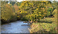
The Sixmilewater, Muckamore (2)
Yesterday was a day of continuous heavy rain. This view, from this footbridge Image, shows the river looking a bit high as it flows downstream, past the colours of autumn.
Image: © Albert Bridge
Taken: 12 Oct 2012
0.04 miles
3
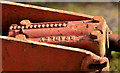
Old crane, Muckamore (1)
There is a disused and rusting diesel-powered crane in the grounds of the old mill. Not accessible to the public, it sits behind a palisade fence beside this footbridge Image To make matters worse the bridge and the fence verticals are not in alignment, making photography of the whole crane impossible. The jib has this inscription “Bradley” on a casting. Image shows the name “Lister” on the engine covers.
Image: © Albert Bridge
Taken: 12 Oct 2012
0.07 miles
4

Old crane, Muckamore (2)
See Image The name “Lister” on the engine covers.
Image: © Albert Bridge
Taken: 12 Oct 2012
0.07 miles
5
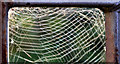
Spiders' webs, Muckamore
Just about every gap in this footbridge Image had a web. This one (eastern side) had several.
Image: © Albert Bridge
Taken: 12 Oct 2012
0.07 miles
6
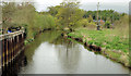
The Sixmilewater at Muckamore
The Sixmilewater, looking downstream, from this footbridge Image There was a carry (race) off the river, which provided power for the nearby mill.
Image: © Albert Bridge
Taken: 14 Apr 2011
0.07 miles
7
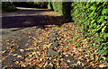
Old path? Muckamore
First the facts. This is Abbeyview leading to the old mill and Raceview (behind me). The Seven Mile Straight is in the background and the old millrace is (mainly out of picture) below the hedge on the left.
Now the speculation. The straight line of paving (right) might be the remains of an old path (known locally as “the workers’ path”) which led to the mill in the days before cars and lorries. Further information very welcome.
Image: © Albert Bridge
Taken: 12 Oct 2012
0.07 miles
8
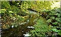
Former millrace, Muckamore (1)
The York Street Flax Spinning Company, Belfast also owned mills at Dunadry, Muckamore and Antrim. Muckamore was powered by a millrace/carry which still survives. Most of it is overgrown and a section has been culverted. This part, where it’s about to enter the Sixmilewater, is at the back of Abbeyview and Raceview, lies immediately downstream of the culvert – see Image
Image: © Albert Bridge
Taken: 12 Oct 2012
0.08 miles
9
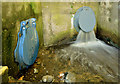
Former millrace, Muckamore (2)
See Image The end of the short culverted section. The flap (left), marked “Stanton”, seems to cover a storm drain.
Image: © Albert Bridge
Taken: 12 Oct 2012
0.08 miles
10
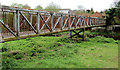
Footbridge, Muckamore
Image: © Albert Bridge
Taken: 14 Apr 2011
0.09 miles