
IMAGES TAKEN NEAR TO
Menin Road, ANTRIM, BT41 4JB
Introduction
This page details the photographs taken nearby to Menin Road, BT41 4JB by members of the Geograph project.
The Geograph project started in 2005 with the aim of publishing, organising and preserving representative images for every square kilometre of Great Britain, Ireland and the Isle of Man.

There are currently over 7.5m images from over14,400 individuals and you can help contribute to the project by visiting https://www.geograph.org.uk
Image Map
Images are licensed for reuse under creativecommons.org/licenses/by-sa/2.0
Notes
- Clicking on the map will re-center to the selected point.
- The higher the marker number, the further away the image location is from the centre of the postcode.
Image Listing (89 Images Found)
Images are licensed for reuse under creativecommons.org/licenses/by-sa/2.0
Image
Details
Distance
1
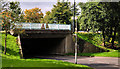
Flyover, Antrim
The flyover carrying the Castle Way (part of the through pass road) across the access to the Castle Mall shopping centre car park.
Image: © Albert Bridge
Taken: 25 Sep 2010
0.09 miles
2
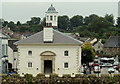
Former courthouse, Antrim (2)
The restored former courthouse Image (now the tourist office) seen from the top of the restored mote in the Castle Gardens.
Image: © Albert Bridge
Taken: 10 Sep 2012
0.10 miles
3
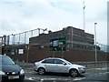
Antrim's PSNI Station, Dublin Road, Antrim
Image: © Eric Jones
Taken: 16 Jun 2013
0.11 miles
4
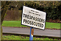
Old "trespass" sign, Antrim
An old local government “trespass” sign in the grounds of a school on the Station Road. Education was transferred to education and library boards (later just education boards) on re-organisation of local government in 1973.
Image: © Albert Bridge
Taken: 27 Dec 2011
0.12 miles
5
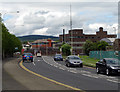
Dublin Road, Antrim
The A26 Dublin Road at Antrim.
Image: © Rossographer
Taken: 18 May 2009
0.13 miles
6
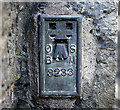
Flush Bracket, Antrim
Flush bracket bench mark located on the front wall of St Comgalls Parish Church, Antrim Image
The number on the bracket is OSBM 3233.
The mark has been levelled to 22.81 metres above MSL.
A flush bracket is a type of bench mark set onto the face of a building. See also http://www.geograph.org.uk/search.php?i=11037856 for many other examples I have found.
Image: © Rossographer
Taken: 28 Jun 2011
0.16 miles
7
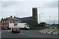
St Comgall?s Church, Castle Street, Antrim
This is one of two Catholic Churches in the Parish of Antrim. The parish was formed from the recent amalgamation of St Congall's and St Joseph's parishes.
http://www.antrimparish.com/
Image: © Eric Jones
Taken: 16 Jun 2013
0.16 miles
8
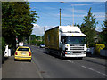
The Oriel Road, Antrim
Mainly residential road running from the Dublin Road towards Antrim Railway Station.
Image: © Rossographer
Taken: 28 Jun 2011
0.16 miles
9
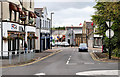
Railway Street, Antrim
Railway Street ran from High Street (hidden, background) to the Station Road. They were severed by the building of the Castle Way through-pass road (foreground). There is still pedestrian access, between the two, by means of a subway (below me).
Image: © Albert Bridge
Taken: 25 Sep 2010
0.16 miles
10
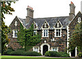
Former Masserene Hospital, Antrim
Built as a workhouse and later part of the Masserene Hospital, on the Station Road, the building has a datestone showing 1842. The hospital closed when the new Antrim Area Hospital Image opened.
Image: © Albert Bridge
Taken: 25 Sep 2010
0.16 miles