
IMAGES TAKEN NEAR TO
Cedar Court, ANTRIM, BT41 4DW
Introduction
This page details the photographs taken nearby to Cedar Court, BT41 4DW by members of the Geograph project.
The Geograph project started in 2005 with the aim of publishing, organising and preserving representative images for every square kilometre of Great Britain, Ireland and the Isle of Man.

There are currently over 7.5m images from over14,400 individuals and you can help contribute to the project by visiting https://www.geograph.org.uk
Image Map
Images are licensed for reuse under creativecommons.org/licenses/by-sa/2.0
Notes
- Clicking on the map will re-center to the selected point.
- The higher the marker number, the further away the image location is from the centre of the postcode.
Image Listing (24 Images Found)
Images are licensed for reuse under creativecommons.org/licenses/by-sa/2.0
Image
Details
Distance
1
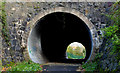
Tunnel, Antrim
The tunnel taking the Riverside (Sixmilewater) Path Image under the Belmont Road Image The view is towards Riverside and the town centre.
Image: © Albert Bridge
Taken: 7 Nov 2012
0.17 miles
2
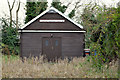
Faith mission hall, Antrim
Traditional wooden mission hall on the eastern side of Riverside.
Image: © Albert Bridge
Taken: 7 Nov 2012
0.18 miles
3
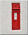
EVIIR wall box, Antrim (2)
See Image A close look at the box (BT41 24).
Image: © Albert Bridge
Taken: 7 Nov 2012
0.18 miles
4
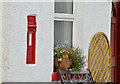
EVIIR wall box, Antrim (1)
An EVIIR wall box (BT41 24) in the wall of a house at Riverside. One of the few postboxes to appear in the list of historic buildings http://www.doeni.gov.uk/niea/built/buildview?id=13161&js=true although it’s not listed – just mentioned. Image is a close look at the box (BT41 24).
Image: © Albert Bridge
Taken: 7 Nov 2012
0.18 miles
5
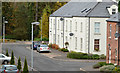
Sixmilewater Mill houses, Antrim
See Image Part of the Sixmilewater Mill development built on the site of the Antrim Weaving Company’s Riverside mill. Sixmilewater Mill Road with Sixmilewater Mill Drive at lower right.
Image: © Albert Bridge
Taken: 7 Nov 2012
0.18 miles
6
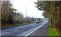
The Belmont Road, Antrim
The Belmont Road runs from the Belfast Road to the Dublin Road allowing through traffic to avoid the town centre. The view is towards the Dublin Road.
Image: © Albert Bridge
Taken: 18 Nov 2007
0.19 miles
7
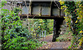
The Sixmilewater railway bridge, Antrim (2012-4)
See Image The bridge crossing the Riverside (Sixmilewater) path. The view is towards Antrim.
Image: © Albert Bridge
Taken: 7 Nov 2012
0.20 miles
8

Ivy flowers, Antrim
Ivy flowers, growing beside the path, between Briarhill and the Sixmilewater.
Image: © Albert Bridge
Taken: 25 Sep 2010
0.21 miles
9

First Presbyterian church, Antrim (2)
The datestone.
Image: © Albert Bridge
Taken: 7 Nov 2012
0.21 miles
10
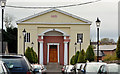
First Presbyterian church, Antrim (1)
The front of the church from Church Street – last seen in Image (November 2005).
Image: © Albert Bridge
Taken: 7 Nov 2012
0.21 miles