IMAGES TAKEN NEAR TO
Church Street, ANTRIM, BT41 4BE

Introduction

This page details the photographs taken nearby to Church Street, BT41 4BE by members of the Geograph project.

The Geograph project started in 2005 with the aim of publishing, organising and preserving representative images for every square kilometre of Great Britain, Ireland and the Isle of Man.

There are currently over 7.5m images from over14,400 individuals and you can help contribute to the project by visiting https://www.geograph.org.uk

Image Map


Images are licensed for reuse under creativecommons.org/licenses/by-sa/2.0
Notes
  • Clicking on the map will re-center to the selected point.
  • The higher the marker number, the further away the image location is from the centre of the postcode.

Image Listing (77 Images Found)

Images are licensed for reuse under creativecommons.org/licenses/by-sa/2.0
  • ...
Image
Details
Distance
1
Church Street, Antrim
The eastern end of Church Street in Antrim as it meets Castle Way and Fountain Street.
Image: © Rossographer Taken: 19 May 2011
0.00 miles
2
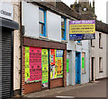
10-12 Church Street, Antrim
Vacant premises at Church Street, described by one of the joint agents thus: “The property currently comprises a 2 storey mid-terrace building to include ground floor shop unit and first floor dwelling with associated outbuildings. Planning Permission has been granted for “provision of 3 no. apartments and shop with new vehicle access and in-curtilage parking. (Including demolition of outbuildings to the rear)”.
Image: © Albert Bridge Taken: 25 Jul 2010
0.02 miles
3
"Chimney Corner" sculpture, Antrim
A sculpture, between Fountain Street and the Castle Way, by Anna Cheyne called “My lady of the Chimney Corner” recalling the book of the same name written by Alexander Irvine Image
Image: © Albert Bridge Taken: 25 Jul 2010
0.03 miles
4
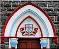
First Antrim Presbyterian church (3)
Detail from the iron gates which includes the church’s name on an archway at the entrance from Church Street. The church and ironwork are listed – see this link http://www.doeni.gov.uk/niea/built/buildview?id=2345&js=true. The building on the right is the Masonic Hall Image
Image: © Albert Bridge Taken: 7 Nov 2012
0.03 miles
5
Butcher, Antrim
Butcher’s shop, in Church Street, using the almost-forgotten term “flesher” Image “Poulterer” has also fallen into disuse.
Image: © Albert Bridge Taken: 25 Jul 2010
0.04 miles
6
Antrim masonic hall (detail)
See Image The detail above the front door.
Image: © Albert Bridge Taken: 25 Jul 2010
0.05 miles
7
Van, Antrim
A van belonging to Morrow Transport of Newtownabbey parked in Church Street, Antrim.
Image: © Rossographer Taken: 19 May 2011
0.05 miles
8
Pogue's Entry, Antrim (2010)
See Image 28 years later, hanging baskets, new whitewash and the view in the opposite direction.
Image: © Albert Bridge Taken: 25 Jul 2010
0.07 miles
9
Shop and petrol pumps, Antrim
An interesting survivor and possibly one of the very few left. A shop, at 83 Church Street, Antrim with two pumps – one petrol and one for diesel. Part of a terrace (mentioned but not listed in http://www.doeni.gov.uk/niea/built/buildview?id=13140&js=true). Said to date from 1860/1879, the description includes “A terrace of five two-storey, two-bay houses, of random rubble basalt walls, with brick dressings to doorways and windows except where later smooth cement rendered; roofs of Bangor blue slates”.
Image: © Albert Bridge Taken: 7 Nov 2012
0.07 miles
10
Access cover, Antrim
Access cover marked "ATE" located on Church Street in Antrim. It bears a remarkable similarity to covers found in Belfast marked "ATM" such as Image Explanations welcomed.
Image: © Rossographer Taken: 19 May 2011
0.08 miles
  • ...