
IMAGES TAKEN NEAR TO
Brae Bungalows, LARNE, BT40 3HB
Introduction
This page details the photographs taken nearby to Brae Bungalows, BT40 3HB by members of the Geograph project.
The Geograph project started in 2005 with the aim of publishing, organising and preserving representative images for every square kilometre of Great Britain, Ireland and the Isle of Man.

There are currently over 7.5m images from over14,400 individuals and you can help contribute to the project by visiting https://www.geograph.org.uk
Image Map
Images are licensed for reuse under creativecommons.org/licenses/by-sa/2.0
Notes
- Clicking on the map will re-center to the selected point.
- The higher the marker number, the further away the image location is from the centre of the postcode.
Image Listing (41 Images Found)
Images are licensed for reuse under creativecommons.org/licenses/by-sa/2.0
Image
Details
Distance
1

Fungus, Glynn (2)
Growing on a stump under several different (but mainly beech) trees.
Image: © Albert Bridge
Taken: 30 Oct 2010
0.08 miles
2
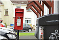
Letter box, Glynn near Larne
Post-mounted EIIR letter box (BT40 685) outside Glynn post office at Glenvale Park. One of Larne Borough Council’s solar-powered litter bins Image is on the right.
Image: © Albert Bridge
Taken: 30 Jun 2013
0.09 miles
3
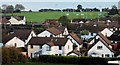
Glenburn Drive, Glenburn Park, Glynn
The view from the Glenburn Road, across this field Image to Glenburn Drive and Glenburn Park. Larne Rugby Club is above them, on the Main Road. Larne Lough is at the top.
Image: © Albert Bridge
Taken: 30 Oct 2010
0.09 miles
4
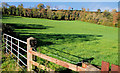
Field, Glynn
A field, on the northern side of the Glenburn Road, untouched by excavator or apartments.
Image: © Albert Bridge
Taken: 30 Oct 2010
0.10 miles
5
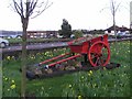
Glynn Village
The cart amongst flowers
Image: © Kenneth Allen
Taken: 8 Mar 2008
0.10 miles
6
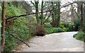
The Glynn River, Glynn (1)
The short Glynn River is quick to react to heavy rain. It flows into Larne Lough at Glynn station Image (same square) so there is probably some tidal effect on its height (taken about 30 mins after high water). St John’s church Image and graveyard is just about visible at middle top. Image shows the tidal effect at the river mouth.
Image: © Albert Bridge
Taken: 5 Feb 2008
0.12 miles
7
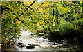
The Glynn River, Glynn (3)
The Glynn River, looking downstream after heavy rain the previous day, near St John’s church.
Image: © Albert Bridge
Taken: 30 Oct 2010
0.12 miles
8
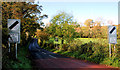
The Glenburn Road, Glynn (1)
The foot of the road at Glynn. The steep part starts past the bend at middle/left.
Image: © Albert Bridge
Taken: 30 Oct 2010
0.12 miles
9
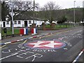
Glynn road markings
The primary school is in the background.
Image: © Kenneth Allen
Taken: 27 Jan 2007
0.12 miles
10
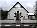
Glynn Village Hall
Built in 1931, it is located close to the village centre.
Image: © Kenneth Allen
Taken: 27 Jan 2007
0.12 miles