
IMAGES TAKEN NEAR TO
Ballysnod Road, LARNE, BT40 3BZ
Introduction
This page details the photographs taken nearby to Ballysnod Road, BT40 3BZ by members of the Geograph project.
The Geograph project started in 2005 with the aim of publishing, organising and preserving representative images for every square kilometre of Great Britain, Ireland and the Isle of Man.

There are currently over 7.5m images from over14,400 individuals and you can help contribute to the project by visiting https://www.geograph.org.uk
Image Map
Images are licensed for reuse under creativecommons.org/licenses/by-sa/2.0
Notes
- Clicking on the map will re-center to the selected point.
- The higher the marker number, the further away the image location is from the centre of the postcode.
Image Listing (18 Images Found)
Images are licensed for reuse under creativecommons.org/licenses/by-sa/2.0
Image
Details
Distance
1
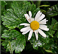
Oxeye daisy, Larne
Oxeye daisy, growing along this path Image, beside the Inver.
Image: © Albert Bridge
Taken: 21 Jul 2011
0.15 miles
2
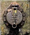
PKS drain cover, Larne
A PKS http://www.geograph.org.uk/search.php?i=23310125 drain cover, between the church Image and the Inver Image Marked “PKS N IRELAND 225mm”
Image: © Albert Bridge
Taken: 21 Jul 2011
0.15 miles
3
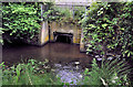
Drain, Larne
Image: © Albert Bridge
Taken: 21 Jul 2011
0.16 miles
5
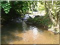
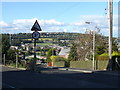
Inver River, Larne
The Inver River at Larne.
Image: © Puffer
Taken: 25 May 2012
0.20 miles
6
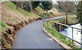
Footpath, Larne
See Image The view towards Larne. The path is on the course of the old railway to Ballymena. The River Inver is on the right.
Image: © Albert Bridge
Taken: 15 Feb 2008
0.20 miles
7
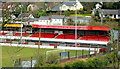
Inver Park, Larne (1)
Part of Inver Park football ground (Larne FC).
Image: © Albert Bridge
Taken: 19 Mar 2011
0.22 miles
8
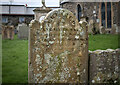
Gravestone, Larne
The damaged gravestone of Isabella Young Workman in the churchyard of St Cedma's in Larne Image She died in 1871, aged 32 years; her mother Jane Workman erected this stone.
Image: © Rossographer
Taken: 18 Feb 2023
0.23 miles
9
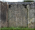
Gravestone, Larne
The gravestone of two children of Robert Houston in the churchyard of St Cedma's in Larne Image Jane died on the 12th October 1755 and John died on the 16th October 1762.
Robert died on the 29th April 1782 aged 62 and his wife Martha died in 25th August 1794 aged 77.
Image: © Rossographer
Taken: 18 Feb 2023
0.23 miles
10
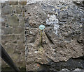
Bench Mark, Larne
Bench mark on the porch of the parish church in Larne (St Cedma's Image). This mark dates from the 1st geodetic levelling of Ireland which took place in 1839-43. It consists of a cut mark with a copper bolt driven into the wall of the church. The mark was included as a side level on the Belfast to Portrush line.
The original remarks describe it as "Larne Church. Copper bolt driven into North-west coinstone of Tower at door; 3.3 ft. above surface."
The mark was originally levelled to 41.5 feet, later revised to 9.84 metres above MSL.
Image: © Rossographer
Taken: 18 Feb 2023
0.23 miles