
IMAGES TAKEN NEAR TO
Mill Road, LARNE, BT40 3BX
Introduction
This page details the photographs taken nearby to Mill Road, BT40 3BX by members of the Geograph project.
The Geograph project started in 2005 with the aim of publishing, organising and preserving representative images for every square kilometre of Great Britain, Ireland and the Isle of Man.

There are currently over 7.5m images from over14,400 individuals and you can help contribute to the project by visiting https://www.geograph.org.uk
Image Map
Images are licensed for reuse under creativecommons.org/licenses/by-sa/2.0
Notes
- Clicking on the map will re-center to the selected point.
- The higher the marker number, the further away the image location is from the centre of the postcode.
Image Listing (23 Images Found)
Images are licensed for reuse under creativecommons.org/licenses/by-sa/2.0
Image
Details
Distance
1
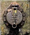
PKS drain cover, Larne
A PKS http://www.geograph.org.uk/search.php?i=23310125 drain cover, between the church Image and the Inver Image Marked “PKS N IRELAND 225mm”
Image: © Albert Bridge
Taken: 21 Jul 2011
0.13 miles
2
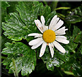
Oxeye daisy, Larne
Oxeye daisy, growing along this path Image, beside the Inver.
Image: © Albert Bridge
Taken: 21 Jul 2011
0.13 miles
3
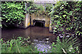
Drain, Larne
Image: © Albert Bridge
Taken: 21 Jul 2011
0.13 miles
4
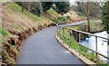
Footpath, Larne
See Image The view towards Larne. The path is on the course of the old railway to Ballymena. The River Inver is on the right.
Image: © Albert Bridge
Taken: 15 Feb 2008
0.14 miles
5
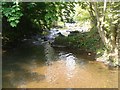
Inver River, Larne
The Inver River at Larne.
Image: © Puffer
Taken: 25 May 2012
0.14 miles
7
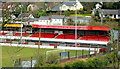
Inver Park, Larne (1)
Part of Inver Park football ground (Larne FC).
Image: © Albert Bridge
Taken: 19 Mar 2011
0.19 miles
9
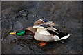
A mallard on the Inver at Larne
The Inver is a short river which flows through Larne before entering Larne Lough close to the railway station. It is shallow. This mallard was standing on the bottom.
Image: © Albert Bridge
Taken: 14 Mar 2007
0.20 miles
10
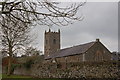
St Cedma's parish church, Larne
St Cedma is believed to have been the father of St Comgall who was born in nearby Magheramorne. The date of construction of this CoI parish church is not known but the tower has a stone with the date “1778”. It is thought that the site was originally occupied by a friary. See also Image
Image: © Albert Bridge
Taken: 14 Mar 2007
0.20 miles