IMAGES TAKEN NEAR TO
Edenvale Terrace, The Roddens, LARNE, BT40 1QJ

Introduction

This page details the photographs taken nearby to Edenvale Terrace, The Roddens, BT40 1QJ by members of the Geograph project.

The Geograph project started in 2005 with the aim of publishing, organising and preserving representative images for every square kilometre of Great Britain, Ireland and the Isle of Man.

There are currently over 7.5m images from over14,400 individuals and you can help contribute to the project by visiting https://www.geograph.org.uk

Image Map


Images are licensed for reuse under creativecommons.org/licenses/by-sa/2.0
Notes
  • Clicking on the map will re-center to the selected point.
  • The higher the marker number, the further away the image location is from the centre of the postcode.

Image Listing (44 Images Found)

Images are licensed for reuse under creativecommons.org/licenses/by-sa/2.0
  • ...
Image
Details
Distance
1
Larne, County Antrim
Looking in the direction of the tower blocks from near Victoria Road
Image: © Kenneth Allen Taken: 28 Oct 2007
0.14 miles
2
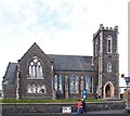
Gardenmore Presbyterian Church, Larne
The origin of the congregation is obscure. Associated with the Seceders, it is said to have existed before 1769 the year in which a meeting house was erected in Pound Street. The original trustees were John Callwell, Samuel Smiley, James McBride, William McClelland, David Dickie and Samuel Ferris. In 1781 the presbytery encouraged them to form a link with the congregation of Islandmagee (now Second Islandmagee) to call a minister. After a number of unsuccessful attempts they called a Scotsman, John Nicholson, who was ordained to the joint charge in 1785. As was customary at that time the ordination took place in a field between the Roddens and the old Carncastle Road. The second minister was George McCaughey and during his ministry Gardenmore and Islandmagee became separate congregations in 1827. At the union of the Synods in 1840 Gardenmore became known in official records as "Second Larne". However in 1885 the congregation received permission from the General Assembly to be known as Gardenmore.
Image: © Kenneth Allen Taken: 28 Oct 2007
0.14 miles
3
St John's Place, Larne
A street, mainly terrace houses, off Pound Street (background).
Image: © Albert Bridge Taken: 21 Jul 2011
0.15 miles
4
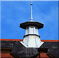
Former Carnegie library, Larne (3)
See Image The building also features this lantern.
Image: © Albert Bridge Taken: 19 Mar 2011
0.17 miles
5
Former Carnegie Library, Larne (2)
See Image The elaborate inscription, incorporating the building date, above the entrance. Continue to Image
Image: © Albert Bridge Taken: 19 Mar 2011
0.17 miles
6
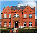
Former Carnegie library, Larne (1)
The former Carnegie Library on the Victoria Road – now restored as a museum and arts centre. Continue to Image
Image: © Albert Bridge Taken: 19 Mar 2011
0.17 miles
7
Larne Library
On Pound Street.
Image: © Richard Webb Taken: 29 Jul 2013
0.19 miles
8
Gardenmore Place, Larne
A street of terrace houses, off Pound Street. This view will change dramatically when Gardenmore House Image (background) is demolished.
Image: © Albert Bridge Taken: 21 Jul 2011
0.20 miles
9
Town Hall, Cross Street, Larne
Looking north from Upper Main Street
Image: © Kenneth Allen Taken: 25 Sep 2010
0.20 miles
10
Plaque, Larne Town Hall
It is located here Image]
Image: © Kenneth Allen Taken: 25 Sep 2010
0.21 miles
  • ...