
IMAGES TAKEN NEAR TO
Glenarm Road, LARNE, BT40 1DZ
Introduction
This page details the photographs taken nearby to Glenarm Road, BT40 1DZ by members of the Geograph project.
The Geograph project started in 2005 with the aim of publishing, organising and preserving representative images for every square kilometre of Great Britain, Ireland and the Isle of Man.

There are currently over 7.5m images from over14,400 individuals and you can help contribute to the project by visiting https://www.geograph.org.uk
Image Map
Images are licensed for reuse under creativecommons.org/licenses/by-sa/2.0
Notes
- Clicking on the map will re-center to the selected point.
- The higher the marker number, the further away the image location is from the centre of the postcode.
Image Listing (45 Images Found)
Images are licensed for reuse under creativecommons.org/licenses/by-sa/2.0
Image
Details
Distance
2
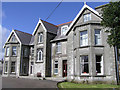
Rathmore House, Larne
It is used as a training centre for the Boy's Brigade
Image: © Kenneth Allen
Taken: 8 Apr 2006
0.03 miles
4
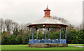
Bandstand, Larne (1)
A general view of the bandstand showing some of the ironwork and the false clock.
Image: © Albert Bridge
Taken: 23 Dec 2011
0.12 miles
5

Bandstand, Larne (2)
Detail from the railings.
Image: © Albert Bridge
Taken: 23 Dec 2011
0.12 miles
6

Bandstand, Larne (3)
One of the columns supporting the roof.
Image: © Albert Bridge
Taken: 23 Dec 2011
0.12 miles
7

Bandstand, Larne (4)
The false clock.
Image: © Albert Bridge
Taken: 23 Dec 2011
0.12 miles
8
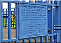
Bandstand, Larne (5)
The commemorative plaque recording the bequest from Robert Thomas Ross.
Image: © Albert Bridge
Taken: 23 Dec 2011
0.12 miles
9
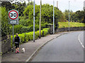
Larne, Glenarm Road
Larne is a seaport and industrial market town on the east coast of County Antrim, with a population of 18,323 people in the 2008 Estimate. It has been used as a seaport for over 1,000 years, and is today a major passenger and freight roll-on roll-off port.
Image: © David Dixon
Taken: 28 Sep 2017
0.12 miles
10

Sandy Bay
The foreshore at the north-west end of Sandy Bay is anything but sandy! In the background are the Ferris Point lighthouse, Chaine Memorial Tower, Ballylumford Power Station and part of the Leisure Centre.
Image: © Anne Burgess
Taken: 31 May 2007
0.13 miles