
IMAGES TAKEN NEAR TO
Bay Road, LARNE, BT40 1DG
Introduction
This page details the photographs taken nearby to Bay Road, BT40 1DG by members of the Geograph project.
The Geograph project started in 2005 with the aim of publishing, organising and preserving representative images for every square kilometre of Great Britain, Ireland and the Isle of Man.

There are currently over 7.5m images from over14,400 individuals and you can help contribute to the project by visiting https://www.geograph.org.uk
Image Map
Images are licensed for reuse under creativecommons.org/licenses/by-sa/2.0
Notes
- Clicking on the map will re-center to the selected point.
- The higher the marker number, the further away the image location is from the centre of the postcode.
Image Listing (185 Images Found)
Images are licensed for reuse under creativecommons.org/licenses/by-sa/2.0
Image
Details
Distance
1
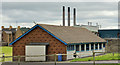
Pavilion, Larne
The pavilion at the Sandy Bay playing fields seen from this path Image
Image: © Albert Bridge
Taken: 27 Jun 2012
0.03 miles
2
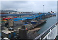
Port of Larne
View from a ferry waiting to depart for Cairnryan. There are four landing stages in a line.
Image: © Andrew Hill
Taken: 14 Apr 2009
0.08 miles
3
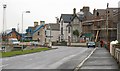
The Chaine Memorial Road, Larne
The Chaine Memorial Road was a road of large detached and semi-detached houses overlooking Sandy Bay. It is now becoming a victim of the apartment virus. One of the harbour floodlights can be seen on the left. Image shows the view in the opposite direction (June 2012).
Image: © Albert Bridge
Taken: 26 Nov 2007
0.09 miles
4
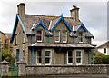
No 88 Bay Road, Larne
A large detached house, with garden, at the corner of the Bay Road and the Chaine Memorial Road (foreground). Advertised for sale as a development opportunity with “Planning permission granted for 9 apartments”. This photograph appears as a matter of record only. I have no connection with any of the parties involved in the sale.
Image: © Albert Bridge
Taken: 27 Jun 2012
0.10 miles
5
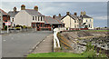
The Chaine Memorial Road, Larne (2)
See Image (November 2007). The Chaine Memorial Road looking in the direction of the Tower Road. Originally called Chaine Memorial Avenue it started at the North Wharf (now the North End). The former entrance to the harbour there (with a marked right of way to the ferry terminal) is now closed to comply with marine and aviation security legislation.
Image: © Albert Bridge
Taken: 27 Jun 2012
0.10 miles
6
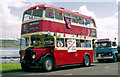
Preserved double decker, Larne (1991)
A preserved Harkness-bodied Daimler double decker (446 OZ 6700), built in 1953 for Belfast Corporation, at the Chaine Memorial Road where it was representing Larne Lions Club in the annual mayoral parade.
Image: © Albert Bridge
Taken: 22 Jun 1991
0.11 miles
7
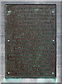
Inscribed plaque, "Princess Victoria" Memorial
The following text is included in the description,
"On the morning of 31st January 1953 the MV 'Princess Victoria' left the East Pier Stranraer to make its normal journey to Larne. Off course Wall Point the shipen countered the full fury of the gale which was that day to cause so much damage and loss of life throughout the country and despite the valliant efforts of her crew, the lifeboat men and other seafearers the 'Princess Victoria' foundered off the coast with the loss of 133 lives, of which those lost, 27 where inhabitants of Larne, whose death this community mournes"
Pictured here Image]
Image: © Kenneth Allen
Taken: 21 Apr 2014
0.11 miles
8
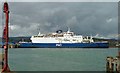
The "Pride of Ailsa" at Larne
Completed in 1976 as the “Free Enterprise VI” operating on the Dover – Zeebrugge/Calais routes. Given additional accommodation in 1985 and re-named the “Pride of Sandwich”. Re-named “Pride of Ailsa” and transferred to Larne – Cairnryan in 1992. She proved a popular ferry and helped to increase the amount of freight carried on the route. Sold in 1996 to operate between Suez and Jeddah as “Pride of Alsalm '95”. Last heard of in 2005 when she sank after colliding with another ship in the Red Sea.
Image: © Albert Bridge
Taken: 4 May 1996
0.11 miles
9

Larne Harbour (1982)
Many changes have taken place since 1982. This shows approximately the same view now Image The building at bottom right was the then terminal building and can be still seen at bottom left in Image The view is from the “Antrim Princess” on the 19.00 sailing to Stranraer where it connected with the sleeper for Euston. The gantry crane and the containers used to convey parcels and mail from Belfast York Road can be seen at top left. The car park (middle/top right) is now the Fleetwood marshalling area. At top right (by the bushes below the factory) were the remains of WWII air-raid shelters. The car park had once been the site of pens and mixed-gauge sidings for livestock traffic. By 1982, however, all traces of the narrow-gauge lines for bauxite traffic had gone.
Image: © Albert Bridge
Taken: 3 Jun 1982
0.11 miles
10

Princess Victoria Memorial
This photo shows the Princess Victoria Memorial at Larne Harbour. In the background is the Chaine Memorial Tower. The MV Princess Victoria (built in 1947 and operating between Stranraer and Larne) sank in the North Channel on 31st January 1953 with the loss of 133 lives.
Image: © Puffer
Taken: 5 Jan 2012
0.12 miles