IMAGES TAKEN NEAR TO
Station Street, BELFAST, BT3 9DB

Introduction

This page details the photographs taken nearby to Station Street, BT3 9DB by members of the Geograph project.

The Geograph project started in 2005 with the aim of publishing, organising and preserving representative images for every square kilometre of Great Britain, Ireland and the Isle of Man.

There are currently over 7.5m images from over14,400 individuals and you can help contribute to the project by visiting https://www.geograph.org.uk

Image Map


Images are licensed for reuse under creativecommons.org/licenses/by-sa/2.0
Notes
  • Clicking on the map will re-center to the selected point.
  • The higher the marker number, the further away the image location is from the centre of the postcode.

Image Listing (2332 Images Found)

Images are licensed for reuse under creativecommons.org/licenses/by-sa/2.0
  • ...
Image
Details
Distance
1
The Station Street/Bridge End flyover, Belfast (4)
See Image The flyover, looking towards Bridge End, seen from Queen’s Quay. Continue to Image
Image: © Albert Bridge Taken: 7 Jun 2009
0.01 miles
2
The Station Street/Bridge End flyover, Belfast
The flyover connecting the Queen’s Road and Bridge End was built when around 25,000 people worked in shipbuilding. The area is undergoing redevelopment and traffic now tends to use the Sydenham bypass and the M3 to avoid the city centre. The flyover, never an outstanding piece of civil engineering, is due to be demolished and replaced by a new road layout in keeping with the expected future traffic requirements. Continue to Image
Image: © Albert Bridge Taken: 1 Jul 2006
0.01 miles
3
Quay Gate, Belfast (July 2014)
See Image (January 2009). The southern side of this block (completed in 2000) seen from the end of the Laganside Walkway, near the Queen’s Bridge. The Station Street/Bridge End flyover http://www.geograph.org.uk/snippet/3747 is at the bottom.
Image: © Albert Bridge Taken: 24 Jul 2014
0.01 miles
4
Station Street/Bridge End flyover, Belfast (6)
See Image The flyover seen from Bridge End, looking towards Queen’s Quay. Continue to Image
Image: © Albert Bridge Taken: 19 Mar 2010
0.01 miles
5
Open-top bus, Belfast
An open-top tourist bus, in the queue, on the flyover at Station Street/Bridge End Image There was severe congestion after an accident at the Westlink/York Street Image
Image: © Albert Bridge Taken: 23 Apr 2010
0.01 miles
6
Station Street/Bridge End flyover, Belfast (7)
See Image The night view towards Bridge End. Station Street is on the left and Queen’s Quay out of picture to the right. Given the current attitude to public spending, rumours of its demise might be exaggerated. Continue to Image
Image: © Albert Bridge Taken: 21 Oct 2010
0.01 miles
7
Flyover graffiti, Belfast (1)
Graffiti on the southern side of the Station Street/Bridge End flyover. See also Image
Image: © Albert Bridge Taken: 28 Jan 2011
0.01 miles
8
Flyover graffiti, Belfast (2)
See Image Graffiti on the western of the Station Street/Bridge End flyover.
Image: © Albert Bridge Taken: 28 Jan 2011
0.01 miles
9
Diversion signs, Belfast (1)
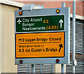
The M3 Image was closed today (“Lanes 1 and 2 closed West bound from Middlepath Street On-slip to Nelson Street Off-slip. Works for Bridge joint repair”) providing the opportunity to see the rotating diversion panels, in the direction signs, in use. This one is at Middlepath Street just past Station Street. See also Image
Image: © Albert Bridge Taken: 8 Aug 2010
0.02 miles
10
Translink towcar, Belfast
A Translink towcar (a converted Leyland Tiger) attending to a broken-down bus, near the end of the Queen Elizabeth Bridge.
Image: © Albert Bridge Taken: 19 Dec 2009
0.02 miles
  • ...