IMAGES TAKEN NEAR TO
Milewater Road, BELFAST, BT3 9BG

Introduction

This page details the photographs taken nearby to Milewater Road, BT3 9BG by members of the Geograph project.

The Geograph project started in 2005 with the aim of publishing, organising and preserving representative images for every square kilometre of Great Britain, Ireland and the Isle of Man.

There are currently over 7.5m images from over14,400 individuals and you can help contribute to the project by visiting https://www.geograph.org.uk

Image Map


Images are licensed for reuse under creativecommons.org/licenses/by-sa/2.0
Notes
  • Clicking on the map will re-center to the selected point.
  • The higher the marker number, the further away the image location is from the centre of the postcode.

Image Listing (97 Images Found)

Images are licensed for reuse under creativecommons.org/licenses/by-sa/2.0
  • ...
Image
Details
Distance
1
The Milewater Road, Belfast
A short cul-de-sac off Duncrue Street in Belfast Harbour Estate.
Image: © Rossographer Taken: 27 Aug 2024
0.03 miles
2
Cycle path in Belfast
Part of a cycle route from Whiteabbey to Belfast, where it passes through the Duncrue Industrial Estate, with newly planted trees to make the industrial nature of this section more attractive.
Image: © Robert Ashby Taken: 1 Oct 2012
0.04 miles
3
Belfast Water Works access cover, Belfast (4)
Another variation on a theme of Belfast Water Works access covers – this one is at Duncrue Street just outward of the Milewater Road. Other examples include Image, Image and Image
Image: © Albert Bridge Taken: 2 Dec 2011
0.05 miles
4
Ulsterbus workshops, Belfast
The Ulsterbus workshops on the western side of Duncrue Street. Before the building of the M2 Image the workshops backed on to the railway. The site was originally that of the workshops of the old Northern Ireland Transport Board (1935-48) and its successor the Ulster Transport Authority (1948-67).
Image: © Albert Bridge Taken: 2 Dec 2011
0.05 miles
5
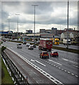
Motorway, Belfast
The M2/M5 motorways as seen from a footbridge at Milewater Road.
Image: © Rossographer Taken: 27 Aug 2024
0.05 miles
6
Motorway and railway, Belfast
25 years ago the M2 had light traffic (see Image). A two-car set was more than sufficient for the few passengers travelling on the 10.25 from Larne Harbour as it approached the isolated York Road station Image
Image: © Albert Bridge Taken: 19 Mar 1984
0.08 miles
7
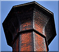
Jennymount Mill, Belfast (6)
The top of the chimney which (to the layman anyway) seems to be in very good condition. If anyone happens to know its height or (better still, having seen the bill of quantities) can confirm the number of bricks used, they might drop me an e-mail.
Image: © Albert Bridge Taken: 30 Apr 2011
0.08 miles
8
Motorway signs, Belfast
Gantry sign for outward traffic, on the Jennymount footbridge Image across the M2, preceding the Fortwilliam junction Image
Image: © Albert Bridge Taken: 15 Oct 2010
0.09 miles
9
Jennymount footbridge, Belfast
Seen by many from below but used by few, this footbridge crosses the M2 and the Belfast – Londonderry/Larne railway. It runs from the Milewater Road towards Ivan Street (background), off the York Road. The previous bridge was not enclosed and was a noted spot for railway photography Image for many years.
Image: © Albert Bridge Taken: 15 Oct 2010
0.09 miles
10
"North Coast Flyer" leaving York Road station, Belfast
In 1990, the Railway Preservation Society of Ireland had no working steam locomotives. Rather than cancel the now well established steam-hauled "Portrush Flyer", the RPSI opted to experiment with diesel haulage using one of Northern Ireland Railway's ex-CIE MV class diesel locomotives, renaming the train the "North Coast Flyer". MV 108 (ex-CIE 230) hauls RPSI vintage coaching stock out of York Road station, Belfast on its way to Portrush. Three "Flyers" were scheduled, but only two operated - the third was cancelled due to lack of demand.
Image: © The Carlisle Kid Taken: 18 Aug 1990
0.09 miles
  • ...