
IMAGES TAKEN NEAR TO
Corry Place, BELFAST, BT3 9AH
Introduction
This page details the photographs taken nearby to Corry Place, BT3 9AH by members of the Geograph project.
The Geograph project started in 2005 with the aim of publishing, organising and preserving representative images for every square kilometre of Great Britain, Ireland and the Isle of Man.

There are currently over 7.5m images from over14,400 individuals and you can help contribute to the project by visiting https://www.geograph.org.uk
Image Map
Images are licensed for reuse under creativecommons.org/licenses/by-sa/2.0
Notes
- Clicking on the map will re-center to the selected point.
- The higher the marker number, the further away the image location is from the centre of the postcode.
Image Listing (403 Images Found)
Images are licensed for reuse under creativecommons.org/licenses/by-sa/2.0
Image
Details
Distance
1
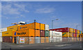
Shipping containers, Belfast
The area around York Dock in Belfast now seems to be used to store shipping containers (empty, I presume, as the dock no longer handles container ships such as Image). These examples are from the German company 'Hapag Lloyd' Image, Finnish based 'Containerships' and Latvian 'Kuršių Linija' Image
Image: © Rossographer
Taken: 17 Apr 2015
0.01 miles
2
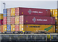
Shipping containers, Belfast
The area around York Dock in Belfast now seems to be used to store shipping containers (empty, I presume, as the dock no longer handles container ships such as Image). These examples are from the Finnish based company 'Containerships' http://www.containershipsgroup.com/ and Latvian company 'Kuršių Linija' http://www.kls.lv/ (which was acquired by the former a few years ago).
Image: © Rossographer
Taken: 17 Apr 2015
0.04 miles
3
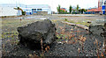
Vacant site, Belfast harbour
Vacant site, with development potential, between Corry Place and Garmoyle Street. Continue to Image
Image: © Albert Bridge
Taken: 23 Sep 2010
0.05 miles
4
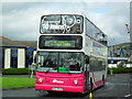
Shuttle Bus - Tall Ships 2009
A Metro Volvo B7TL/Alexander decker arrives from the Boucher Road Park and Ride to Clarendon Dock - with visitors to the Tall Ships Festival.
Image: © Dean Molyneaux
Taken: 15 Aug 2009
0.06 miles
5
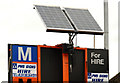
Solar panel, Belfast
A solar panel powering a mobile road sign (similar to this one Image) in Garmoyle Street. The other side of the sign advises drivers that Corporation Street Image has re-opened to through traffic.
Image: © Albert Bridge
Taken: 5 Feb 2010
0.06 miles
6
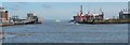
Belfast Harbour
The white vessel is the high speed catamaran service leaving for Stranraer. The building with the curved roof, in front of the silos on the left is the Stena Line terminal.
Image: © Michael Parry
Taken: 19 Apr 2005
0.07 miles
7
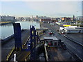
Stena Line Terminal, Belfast
On board the Stena Ferry, with a view down the River Lagan to the centre of Belfast.
Image: © Colin Park
Taken: 21 Oct 2003
0.07 miles
8
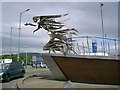
The Flying Angel
Sculpture by Maurice Harron at The Mission to Seafarers at Princes Dock Street Belfast.
Image: © Paul McIlroy
Taken: 1 Jun 2006
0.07 miles
9
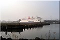
Stena Caledonia
Stena Caledonia, at the Stenaline Terminal, Ballast Quay.
Image made from across the river at the Victoria Wharf, Queens Island.
Image: © Wilson Adams
Taken: 23 Nov 2003
0.07 miles
10
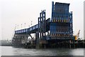
Stenaline Vehicle loading ramp
Stenaline Vehicle loading ramp at the Ballast Quay. These ramps are used to load vehicles onto the conventional ferry, Stena Caledonia.
Image: © Wilson Adams
Taken: Unknown
0.07 miles