IMAGES TAKEN NEAR TO
Ballymena Road, BALLYCLARE, BT39 0TP
Introduction
This page details the photographs taken nearby to Ballymena Road, BT39 0TP by members of the Geograph project.
The Geograph project started in 2005 with the aim of publishing, organising and preserving representative images for every square kilometre of Great Britain, Ireland and the Isle of Man.

There are currently over 7.5m images from over14,400 individuals and you can help contribute to the project by visiting https://www.geograph.org.uk
Image Map
Images are licensed for reuse under creativecommons.org/licenses/by-sa/2.0
Notes
- Clicking on the map will re-center to the selected point.
- The higher the marker number, the further away the image location is from the centre of the postcode.
Image Listing (5 Images Found)
Images are licensed for reuse under creativecommons.org/licenses/by-sa/2.0
Image
Details
Distance
1
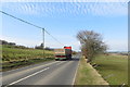
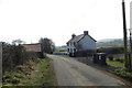
Ballymena Road
The Ballymena Road between Doagh and Kells.
Image: © Robert Ashby
Taken: 19 Mar 2015
0.11 miles
2
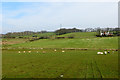
Near Tardree
Sheep grazing on farmland to the north of the Ballymena Road.
Image: © Robert Ashby
Taken: 19 Mar 2015
0.17 miles
3
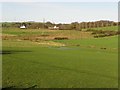
Tardee Townland
Looking north from the Ballymena Road
Image: © Kenneth Allen
Taken: 13 Nov 2009
0.18 miles
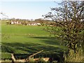
5
Ballygowan Road
Farmhouse on Ballygowan Road near Tardree Forest.
Image: © Robert Ashby
Taken: 19 Mar 2015
0.23 miles