IMAGES TAKEN NEAR TO
Brackenberg Drive, CARRICKFERGUS, BT38 9HU

Introduction

This page details the photographs taken nearby to Brackenberg Drive, BT38 9HU by members of the Geograph project.

The Geograph project started in 2005 with the aim of publishing, organising and preserving representative images for every square kilometre of Great Britain, Ireland and the Isle of Man.

There are currently over 7.5m images from over14,400 individuals and you can help contribute to the project by visiting https://www.geograph.org.uk

Image Map


Images are licensed for reuse under creativecommons.org/licenses/by-sa/2.0
Notes
  • Clicking on the map will re-center to the selected point.
  • The higher the marker number, the further away the image location is from the centre of the postcode.

Image Listing (21 Images Found)

Images are licensed for reuse under creativecommons.org/licenses/by-sa/2.0
  • ...
Image
Details
Distance
1
Main Street, Ballycarry
Attractive terrace of white painted houses in Main Street, Ballycarry.
Image: © Robert Ashby Taken: 17 Jul 2013
0.15 miles
2
Pillar box, Ballycarry
EIIR pillar box (BT38 85) at Ballycarry post office, Main Street.
Image: © Albert Bridge Taken: 30 Jun 2013
0.15 miles
3
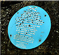
Edward Brice plaque, Ballycarry (2)
See Image The plaque in its setting with the ruins of Templecorran old church in the background.
Image: © Albert Bridge Taken: 17 Sep 2012
0.16 miles
4
Edward Brice plaque, Ballycarry (1)
A plaque, close to Templecorran old church, commemorating Edward Brice. It reads “This plaque was erected on September 5th 1993 to mark the 380th anniversary of the ministry in this village of Edward Brice of Drymen, Stirlingshire, the first minister of the Kirk in Broadisland and first Presbyterian minister in Ireland. He served his people well until 1636, when having remained true to his principles, he was forbidden to minister by the authorities of the day and died heartbroken”. Image and Image show the present Church of Scotland in Drymen. This link explains the cicumstances leading to his demise http://en.wikipedia.org/wiki/Edward_Brice. Image shows the plaque in its setting.
Image: © Albert Bridge Taken: 17 Sep 2012
0.16 miles
5
Mural, Ballycarry
It is located at the centre of the village on West Street, adjacent to Main Street
Image: © Kenneth Allen Taken: 24 Apr 2010
0.16 miles
6
Ulster Scots fingerpost sign, Ballycarry (May 2017)
A fingerpost sign, close to Templecorran old church http://www.geograph.org.uk/snippet/7203 with distances to places of Ulster Scots interest.
Image: © Albert Bridge Taken: 10 May 2017
0.16 miles
7
War memorial, Ballycarry (May 2017)
Most war memorials were erected in the period immediately after WW1. This one is more recent having being dedicated in October 2014. See also Image
Image: © Albert Bridge Taken: 10 May 2017
0.17 miles
8
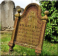
Headstone, Templecorran old church, Ballycarry (4)
See Image The almost illegible and lichen-covered inscription on the back showing that it was made by the Millfield Foundry, Belfast.
Image: © Albert Bridge Taken: 5 Jun 2012
0.20 miles
9
Headstone, Templecorran old Church, Ballycarry (3)
A cast-iron headstone made by the Millfield Foundry, Belfast Image Quite difficult to decipher in the photograph but the original reads “Family burying ground of Stewart M Caw. In memory of his daughter Susanna who died April 1860 aged 14 years”.
Image: © Albert Bridge Taken: 5 Jun 2012
0.20 miles
10
Templecorran old church, Ballycarry (2)
The eastern side of the ruins of the church. Now minus the ivy and much improved since last seen almost five years ago Image
Image: © Albert Bridge Taken: 5 Jun 2012
0.21 miles
  • ...