IMAGES TAKEN NEAR TO
Loughmourne Road, CARRICKFERGUS, BT38 9AW
Introduction
This page details the photographs taken nearby to Loughmourne Road, BT38 9AW by members of the Geograph project.
The Geograph project started in 2005 with the aim of publishing, organising and preserving representative images for every square kilometre of Great Britain, Ireland and the Isle of Man.

There are currently over 7.5m images from over14,400 individuals and you can help contribute to the project by visiting https://www.geograph.org.uk
Image Map
Images are licensed for reuse under creativecommons.org/licenses/by-sa/2.0
Notes
- Clicking on the map will re-center to the selected point.
- The higher the marker number, the further away the image location is from the centre of the postcode.
Image Listing (3 Images Found)
Images are licensed for reuse under creativecommons.org/licenses/by-sa/2.0
Image
Details
Distance
1
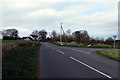
Road Junction
The Junction of Lough Mourne Road, sometimes spelt Loughmourne, and Carneal Road.
Image: © Robert Ashby
Taken: 13 Apr 2014
0.18 miles
2
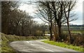
The Carneal Road near Carrickfergus
The Carneal Road runs off the Lough Mourne Road to the west of Lough Mourne Image
Image: © Albert Bridge
Taken: 22 Mar 2008
0.18 miles
3
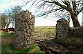
Farm gate near Lough Mourne
This gate is on the Carneal Road Image There is a track, to the immediate left, leading to the NW shore of Lough Mourne Image
Image: © Albert Bridge
Taken: 22 Mar 2008
0.20 miles