IMAGES TAKEN NEAR TO
McKeens Avenue, CARRICKFERGUS, BT38 7HS

Introduction

This page details the photographs taken nearby to McKeens Avenue, BT38 7HS by members of the Geograph project.

The Geograph project started in 2005 with the aim of publishing, organising and preserving representative images for every square kilometre of Great Britain, Ireland and the Isle of Man.

There are currently over 7.5m images from over14,400 individuals and you can help contribute to the project by visiting https://www.geograph.org.uk

Image Map


Images are licensed for reuse under creativecommons.org/licenses/by-sa/2.0
Notes
  • Clicking on the map will re-center to the selected point.
  • The higher the marker number, the further away the image location is from the centre of the postcode.

Image Listing (136 Images Found)

Images are licensed for reuse under creativecommons.org/licenses/by-sa/2.0
  • ...
Image
Details
Distance
1
Old Bridge at Taylors Avenue
The original bridge at Taylors Avenue, constructed in concrete by the LMS/NCC in 1929
Image: © Wilson Adams Taken: 1 Aug 2005
0.03 miles
2
Railway renewal, Barn (2)
See Image Eight days later, the view towards, Carrickfergus and Belfast, where the new up line has been laid but is still without ballast. The 13.20 Whitehead – Belfast Central is passing “wrong line” on the down line. The old Taylor’s Avenue bridge Image is in the background. It was replaced by the present structure Image
Image: © Albert Bridge Taken: 20 Apr 1997
0.03 miles
3
Railway crossover, Barn, Carrickfergus
A facing crossover, under this bridge Image, on the Carrickfergus side of the site of the former Barn station Image
Image: © Albert Bridge Taken: 28 Nov 2013
0.03 miles
4
Train passing Barn station - 1986
A 3-car 450 class passes the remains of Barn station with the 11.00 passenger service from Belfast (York Road) to Larne Harbour. The state of the track and the significant weed growth indicated the parlous state of UK public transport finance in the 1980s.
Image: © The Carlisle Kid Taken: 17 Aug 1986
0.03 miles
5
The Courtyard, Carrickfergus
Former houses, at the Scotch Quarter, converted into shops.
Image: © Albert Bridge Taken: 3 Mar 2010
0.03 miles
6
The town wall, Carrickfergus (8)
A remaining part of the town wall close to McKeen’s Avenue. The retaining wall for the Taylor’s Avenue bridge Image is in the background.
Image: © Albert Bridge Taken: 28 Nov 2013
0.04 miles
7
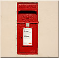
Letter box, Carrickfergus
GVIR box on the wall of a coffee shop at The Courtyard Image
Image: © Albert Bridge Taken: 3 Mar 2010
0.04 miles
8
Unfinished apartments, Carrickfergus (1)
Work stopped some time ago.
Image: © Albert Bridge Taken: 3 Mar 2010
0.05 miles
9
Unfinished apartments, Carrickfergus (2)
Thirteen months later the uncompleted development, in the Scotch Quarter, is being offered for sale. The agents’ website describes it as “Development site Full Planning Permission for 24 2-bed apartments in 3 blocks Blocks A and B partially constructed Block C with foundations in place Relevant Planning references: V/2006/0156/F and V/2007/0302/F Site area: 0.44 acres (approx.)” Demolition and site clearance was taking place in March 2007 Image
Image: © Albert Bridge Taken: 20 Apr 2011
0.05 miles
10
Urban manhole cover, Carrickfergus
An anonymous manhole cover at the Scotch Quarter. Marked “ MA 60 BS 497 DUCTILE GRADE A URBAN”.
Image: © Albert Bridge Taken: 16 Jan 2011
0.05 miles
  • ...