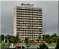
1
Pillar box, Rathcoole, Newtownabbey
EIIR pillar box (no number visible but it should be BT37 247) at Rathcoole Drive, near Ardfarn Close.
Image: © Albert Bridge
Taken: 9 Jun 2012
0.09 miles
2
Northern Side of Belfast Lough
Taken from the top of Cave Hill, showing the Northern Shores on Belfast Lough from North Belfast up to Kilroot Power Station.
In the Lough can just be seen the mussel dredger 'Emerald Gratia' http://www.geograph.org.uk/search.php?i=1801055
Image: © Rossographer
Taken: 20 Oct 2007
0.13 miles
3
Giant butterbur, Newtownabbey
Giant butterbur is often found along riverbanks
Image This clump was growing beside the Glas-na-Bradan river.
Image: © Albert Bridge
Taken: 18 May 2011
0.16 miles
4
Pillar box, Rathcoole, Newtownabbey
EIIR pillar box (BT37 460), outside the post office, at Rathmullan Drive.
Image: © Albert Bridge
Taken: 9 Jun 2012
0.18 miles
5
Path, Glas-na-Bradan, Newtownabbey (3)
A straight section of path, lined by a good display of spring flowers. The Glas-na-Bradan river is hidden on the right.
Image: © Albert Bridge
Taken: 18 May 2011
0.18 miles
6
"Strength" sculpture, Rathcoole, Newtownabbey
See
Image A sculpture, by Gary Armstrong, entitled “Strength”, representing “the strength of the family unit”, close to The Diamond. Monkscoole House
Image is in the background.
Image: © Albert Bridge
Taken: 9 Jun 2012
0.19 miles
7
Monkscoole House, Rathcoole, Newtownabbey
Monkscoole House is one of four 15 storey tower blocks, in the Rathcoole estate, built in the mid-1960’s. It can be seen, on the right, in this elevated view
Image
Image: © Albert Bridge
Taken: 9 Jun 2012
0.21 miles
8
Abbotscoole House, Rathcoole, Newtownabbey
Abbotscoole House is one of four 15 storey tower blocks, in the Rathcoole estate, built in the mid-1960’s. It can be seen, second right, in this elevated view
Image
Image: © Albert Bridge
Taken: 9 Jun 2012
0.24 miles
9
Path, Glas-na-Bradan, Newtownabbey (2)
See
Image The same path looking in the opposite direction. The twisting path almost exactly copies the course of the Glas-na-Bradan river (well hidden by the trees on the left).
Image: © Albert Bridge
Taken: 18 May 2011
0.24 miles
10
Rathcoole
The Rathcoole estate as seen from Cave Hill. Built in the 1950s as homes for those displaced by the demolition of inner city housing in the centre of Belfast. See http://en.wikipedia.org/wiki/Rathcoole_(Belfast) for an overview of the areas history.
Image: © Rossographer
Taken: 19 Dec 2009
0.25 miles


